Visitor Guide to Bridal Veil Falls (Clark Fork’s Canyon)

Background on Bridal Veil Falls

Bridal Veil Falls is truly a hidden gem! The falls are nestled in Clark Fork’s Canyon. It lies just outside of Clark and 40 miles north of Cody.

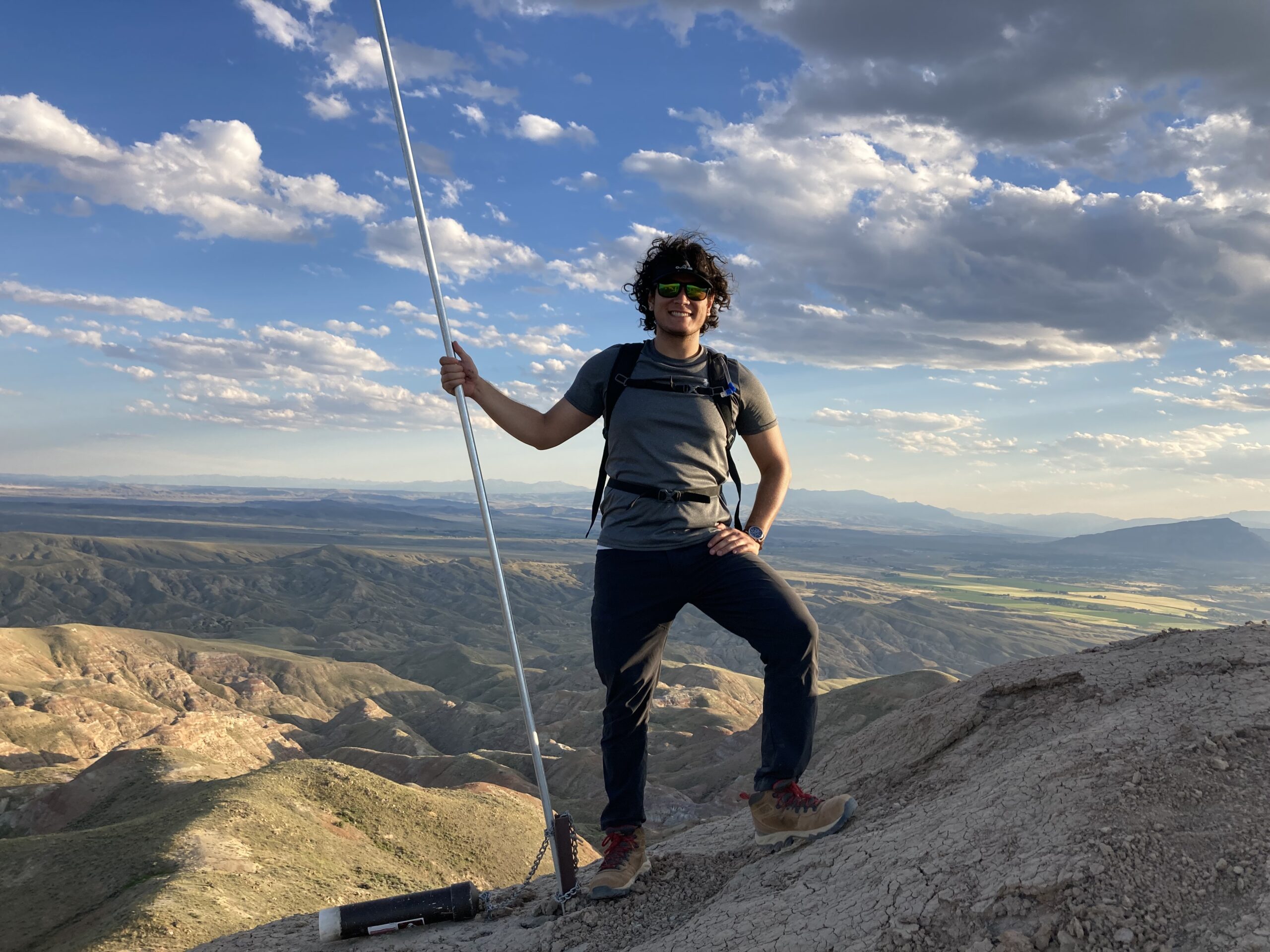
I undertook this hike with my friend (and great dance teacher) Mark Fisher, I have referenced his website in all of my other reviews! I knew next to nothing about this area and the history behind it until I spoke with him and read what he has on his site about Bridal Veil Falls. So, instead of doing my best to remember what he said I’ll link it for you here!

I happened to get out to Bridal Veil Falls shortly after the record breaking flooding that occurred all over Park County in the summer of 2022. The devastating floods shocked people all over the world. Most of the attention was on Yellowstone, so impacted areas outside of the Park went unnoticed.

Clark Fork’s Canyon was drastically impacted by the flooding that took place. I didn’t get to see what Clark Fork’s Canyon looked like before the floods. If you read my first blog post, you’d know that I moved to Park County right as the flooding was happening!

From a distance, the trail has been washed out by the flooding

Access

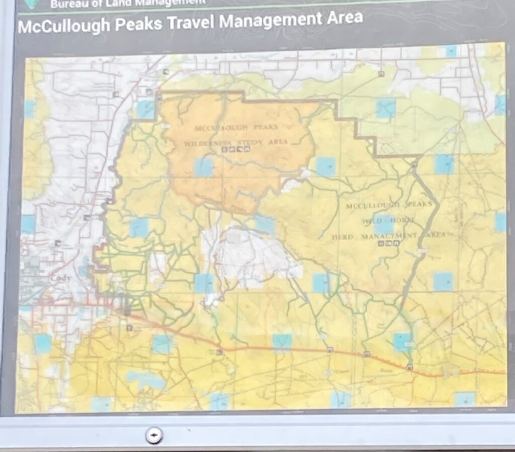
The Forest Service manages Bridal Veil Falls.

The parking area is located on BLM owned land but Clark’s Fork Canyon is solidly FS land. Bridal Veil Falls is easy to access in this regard because it is all public land. You just need to follow the rules that the FS employs.

This article will be a bit different from my others so far. As I mentioned earlier I hiked up to bridal veil falls with someone else who knew the area well. But don’t worry, as we hiked I kept the visitor POV in mind!

It was incredibly helpful to have someone who knew the area showing me around. I felt much more relaxed than while on my solo hikes because I didn’t have to think about directions. Its also just plain fun to have someone else to talk to!

Positives

  • Clark’s Fork Canyon is almost entirely on public land
  • Parking area was easy to access from the road, no need for a vehicle with high clearance or 4WD capability
  • Morrison Jeep Trail is easy to follow
  • Absolutely stunning area visually
  • It takes just about 2 hours to hike to and back from Bridal Veil Falls

Negatives

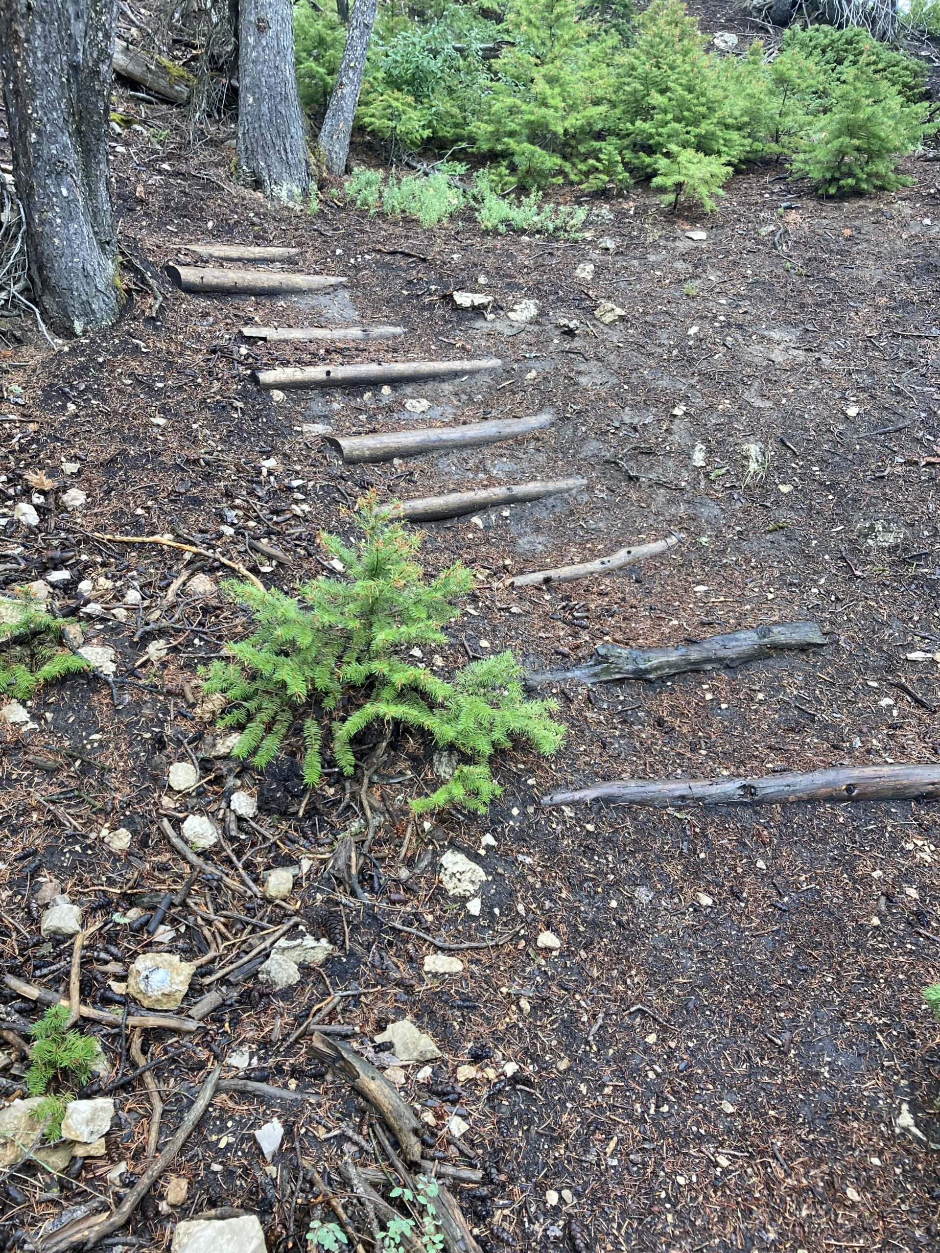
  • Large rocks completely covered the trail, making walking a bit difficult
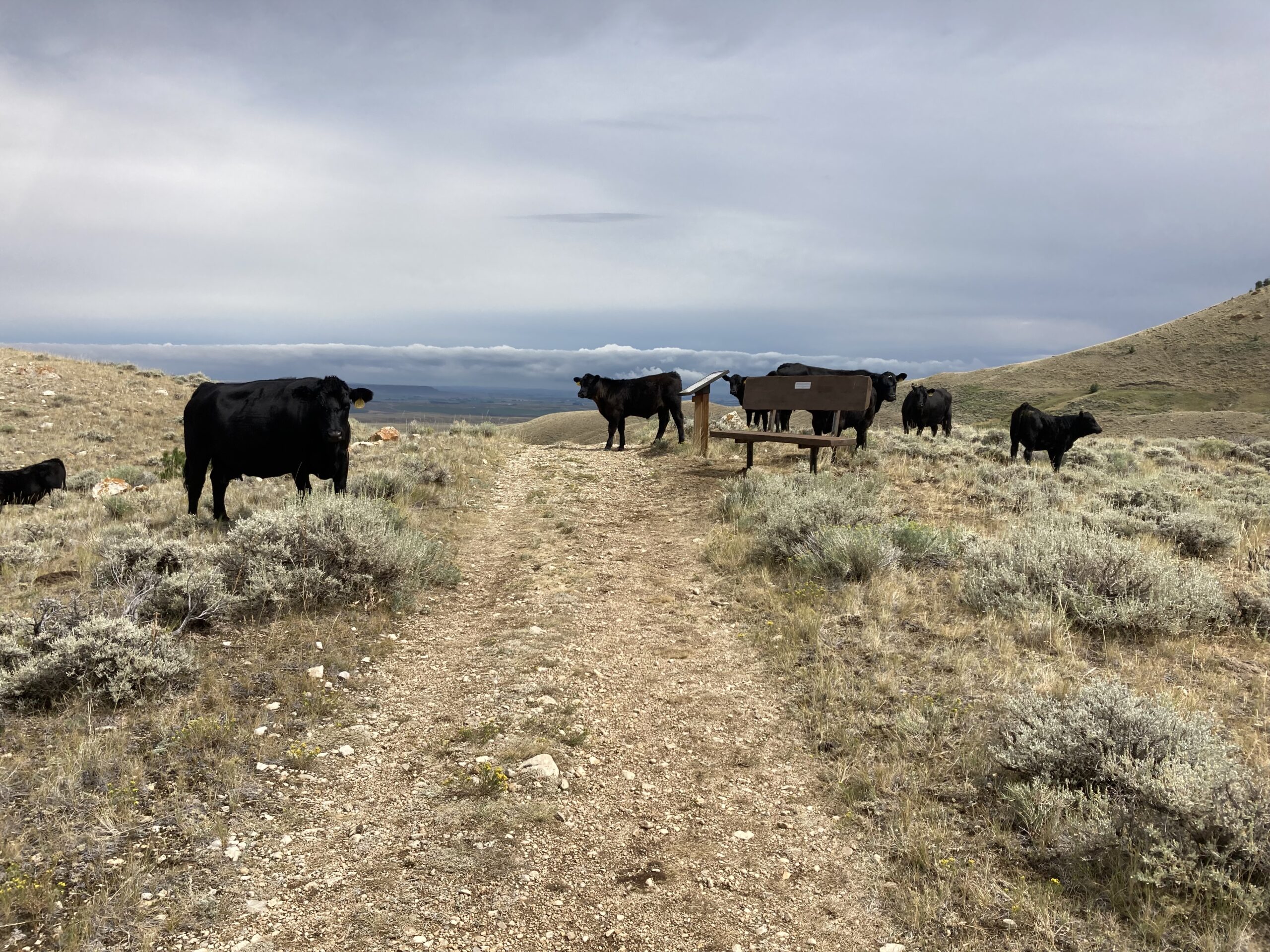
  • It is impossible to see the falls from the trail, which was very confusing to me
Try to see if you can spot the falls from the trail! (You can’t)
  • The parking area suddenly stops. It is directly connected to the road. So visitors need to be extremely careful when driving at speed. People have died going off the end of the parking area.
  • Not much infrastructure here to show the way.

Directions

The coordinates for the parking area are 44.846345, -109.314004.

From Cody, drive north on 120. Then take a left on 292, this turn will be 30 miles down the road. 292 will lead directly to Morrison Jeep Trail.

From Powell, drive west on Lane 9. Follow this street to the end and turn right on badger basin road which becomes 294. Follow 294 to the end and turn left onto 120. From 120 you will take a quick right onto 292 and follow this to the Morrison Jeep Trail.

The Hike

This 3.8 mile out and back hike to Bridal Veil Falls took Mark and I about 2 1/2 hours to complete. You can expect to gain just under 1000ft in elevation. This shorter hike is a breeze physically. However, the stretch leading up to the falls where it gets rocky is a challenge due to slippery rocks and light climbing.
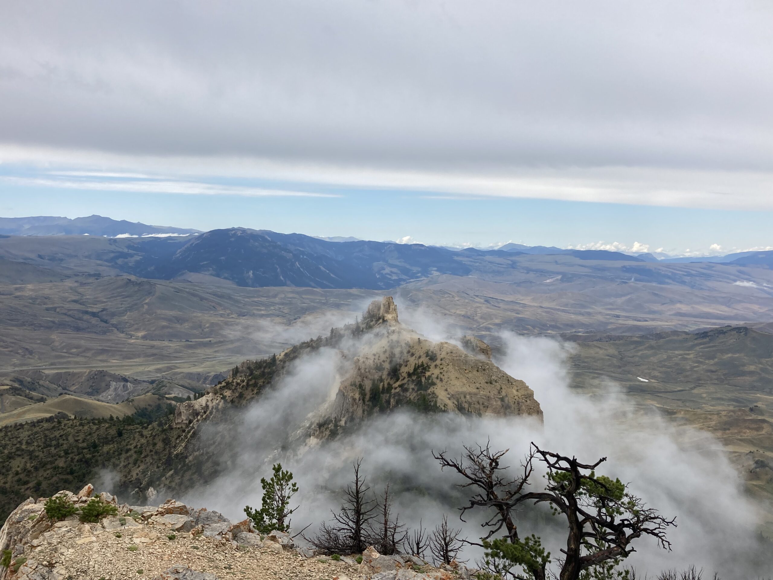
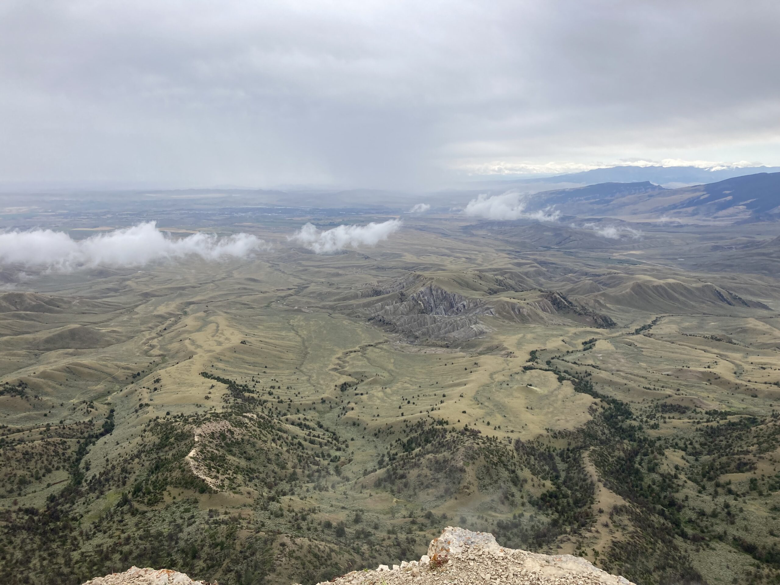
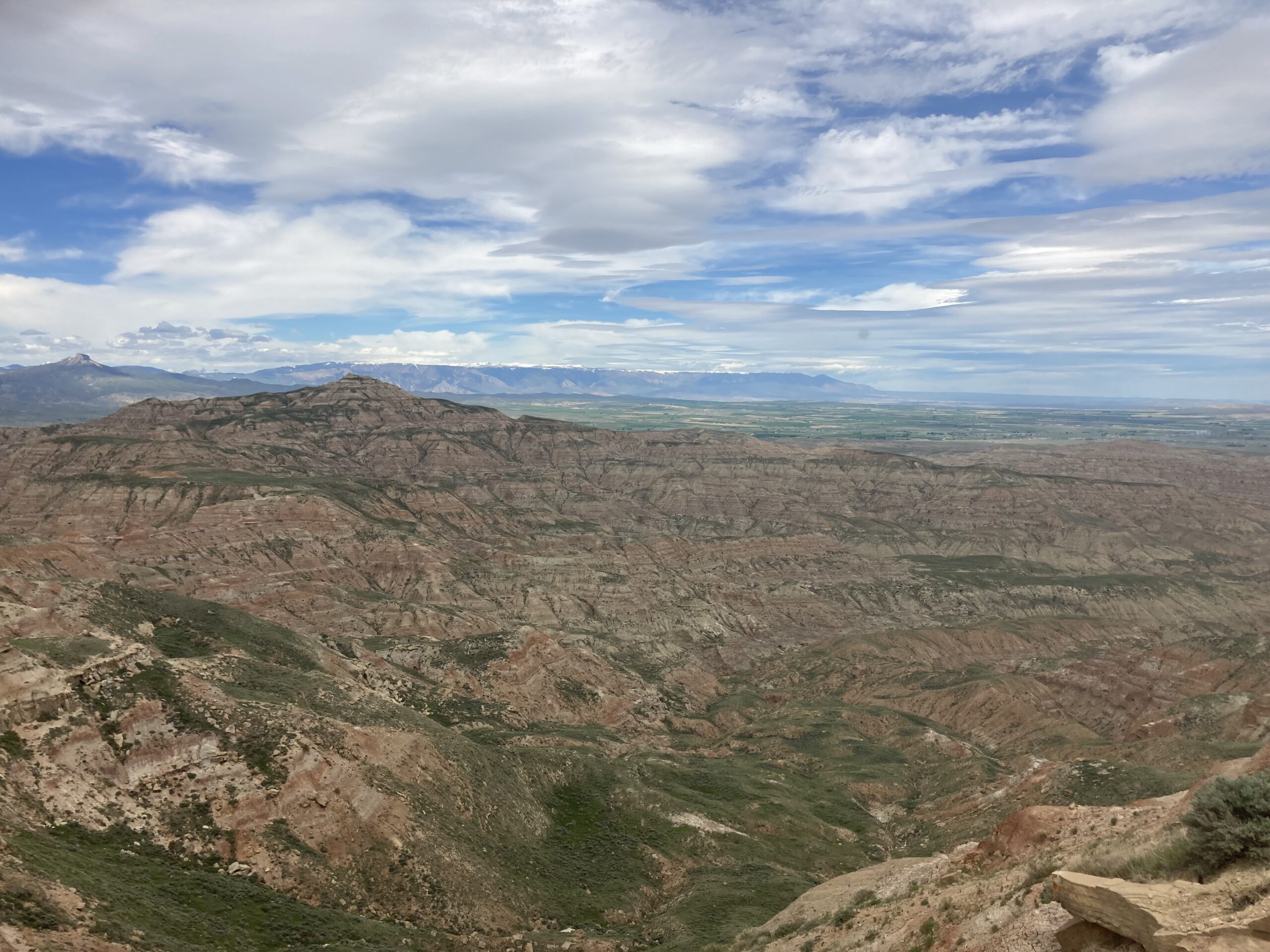
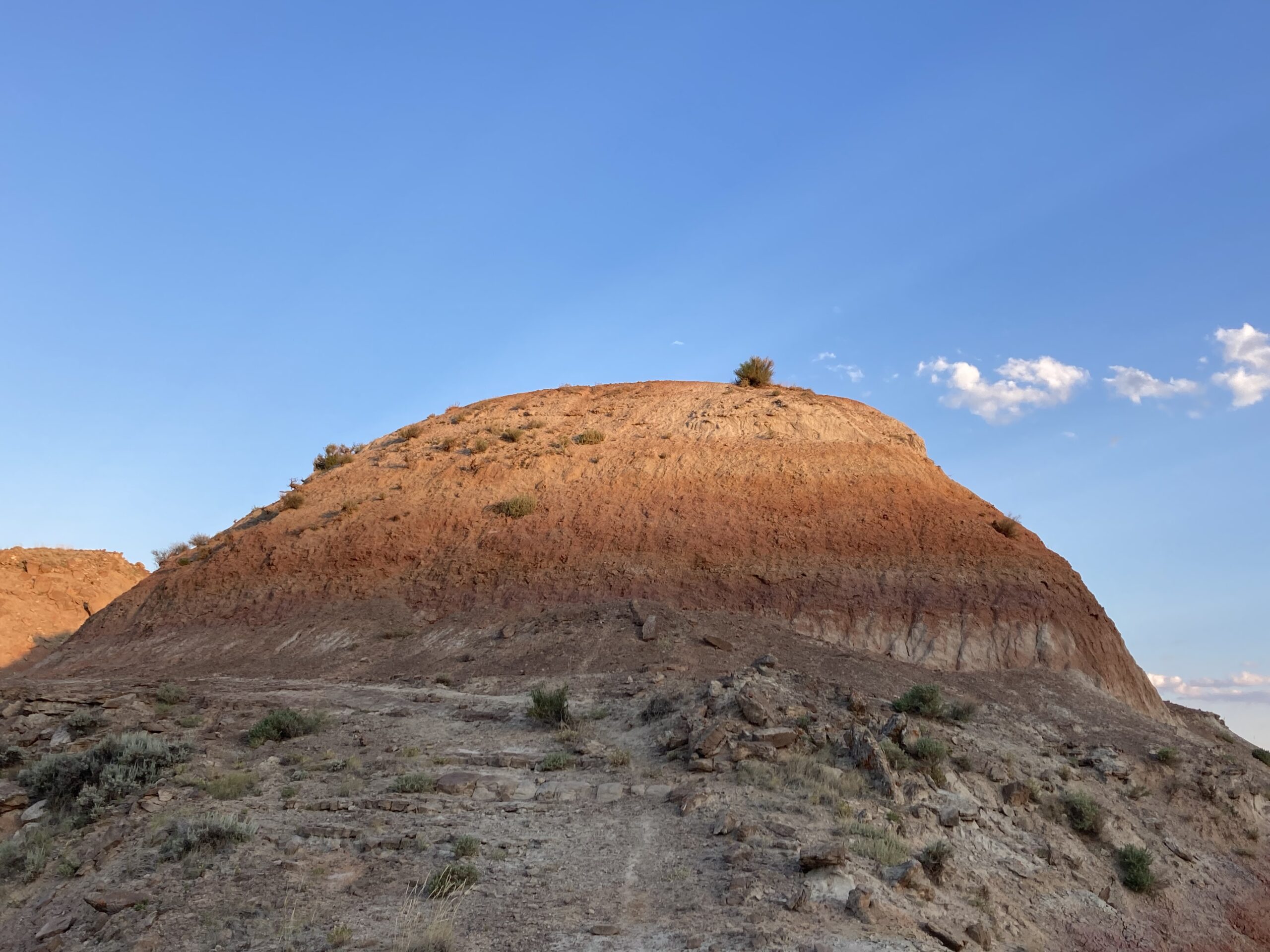
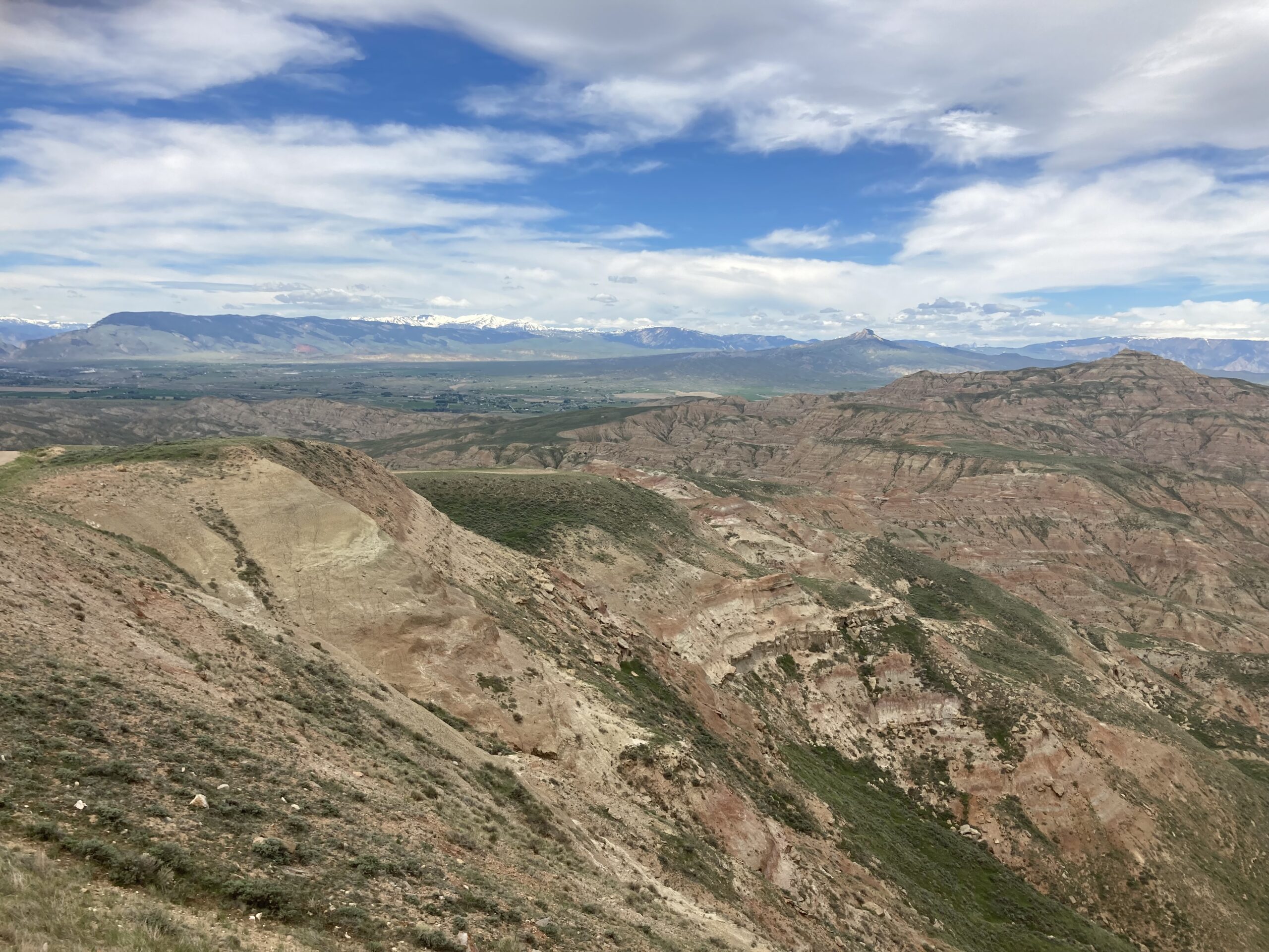
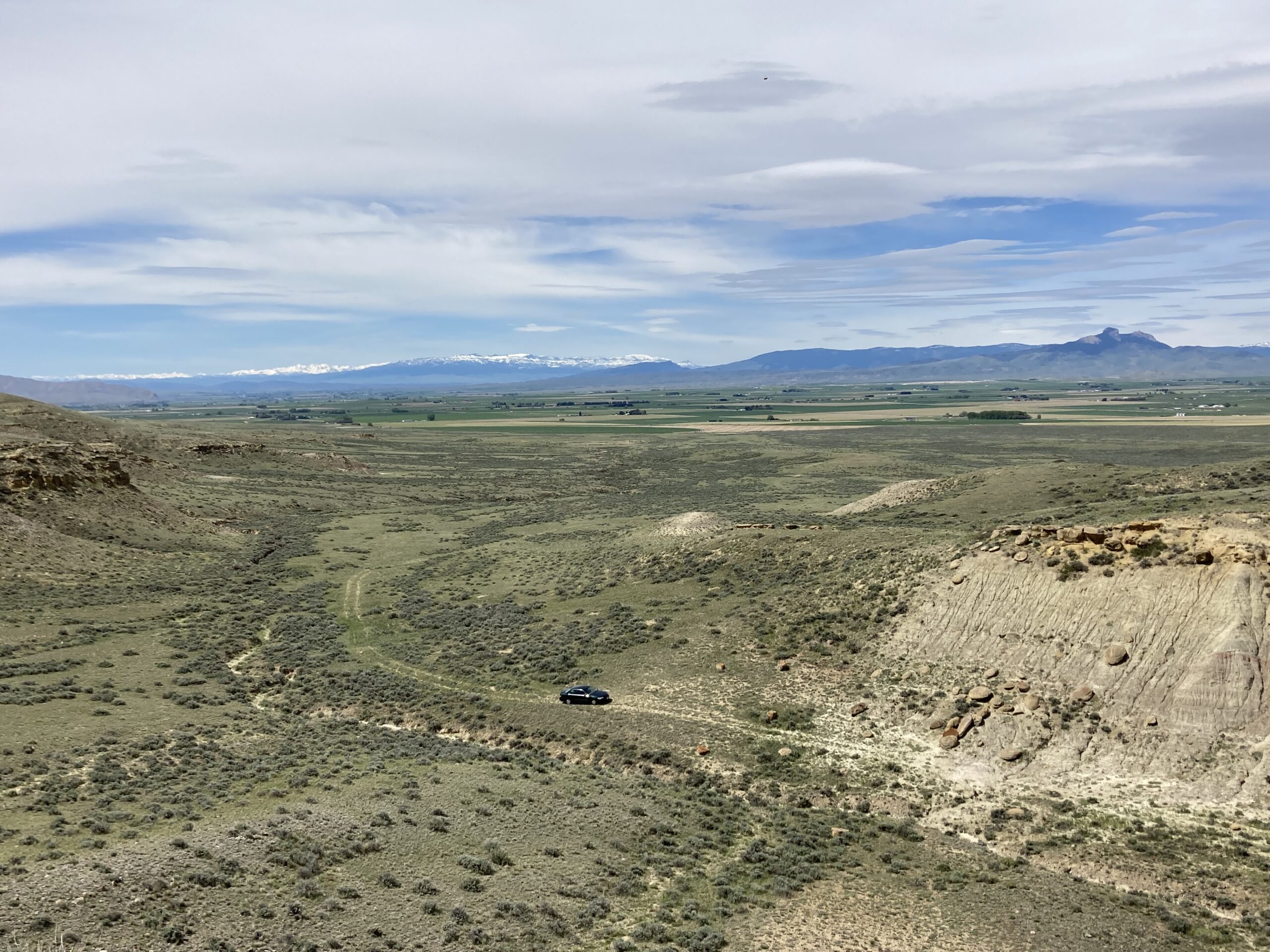
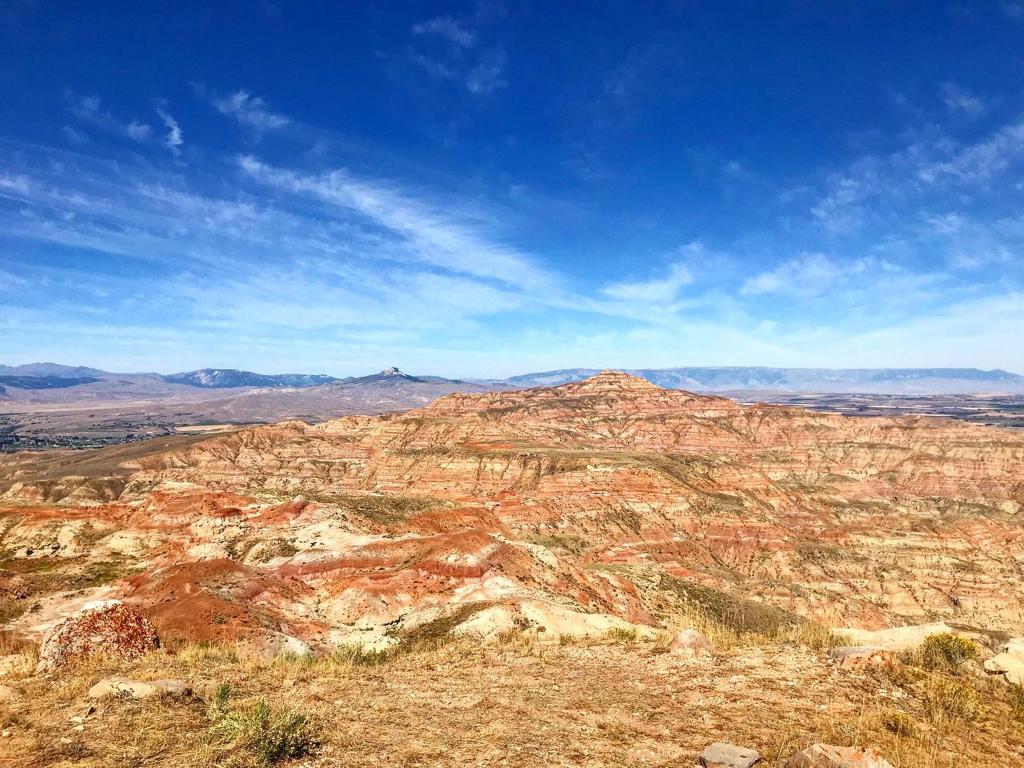
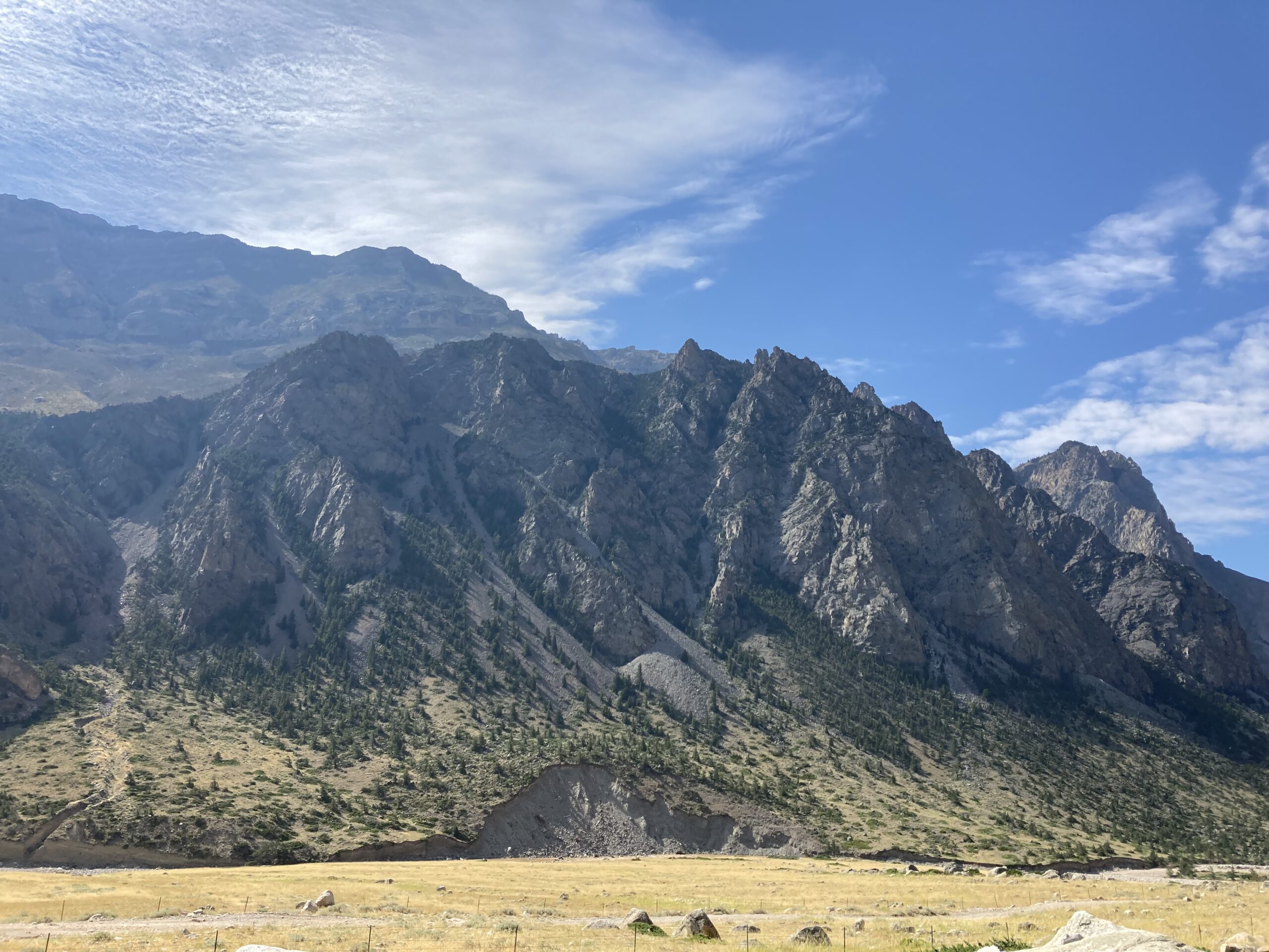
The Canyon

Clark’s Fork Canyon is a beautiful place.

Incredible rock formation in Clark Fork’s Canyon.

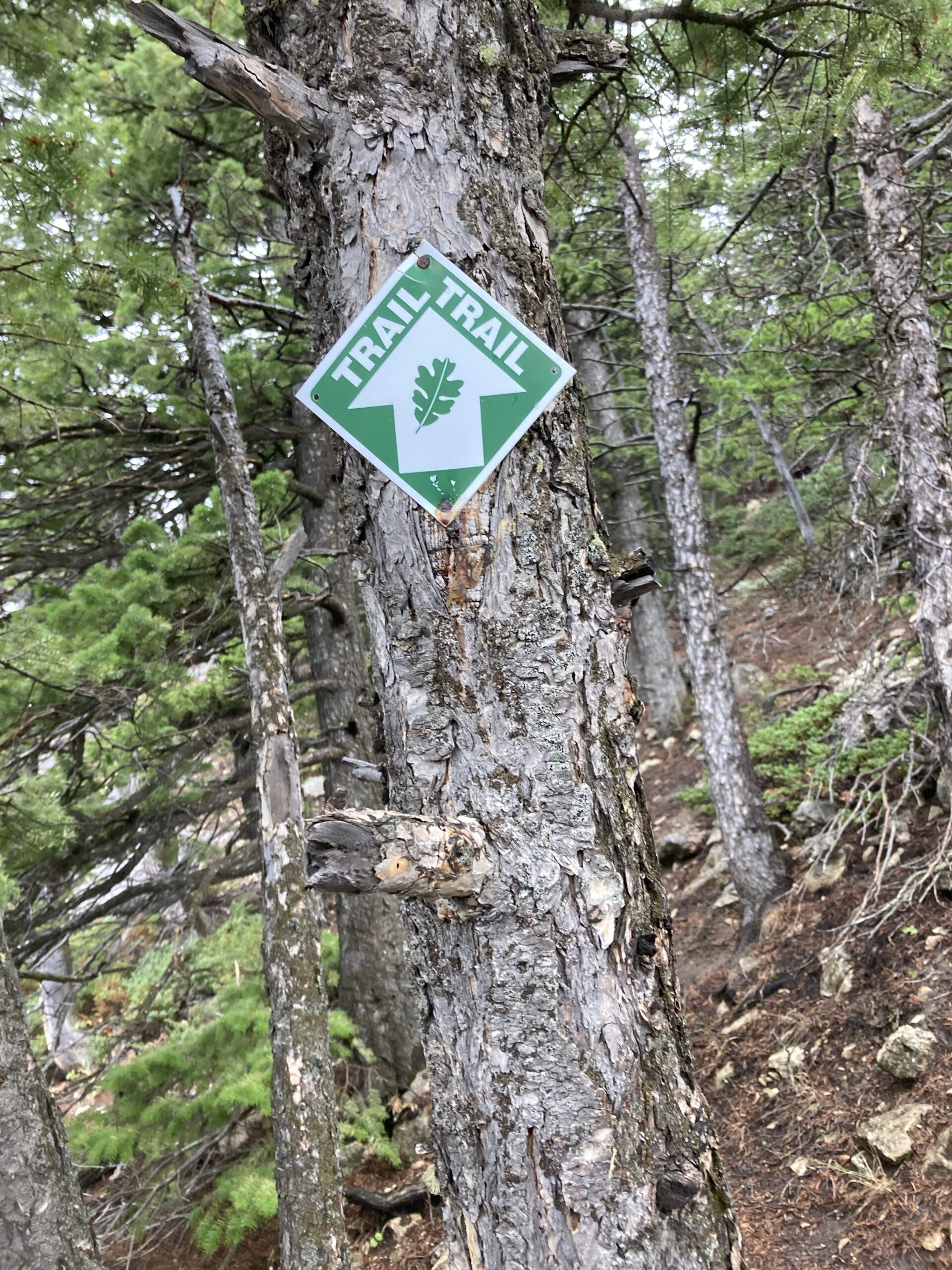
Setting off from the area where we parked at was simple. There was even a gate and sign to let us know we were in the right place and headed in the right direction.

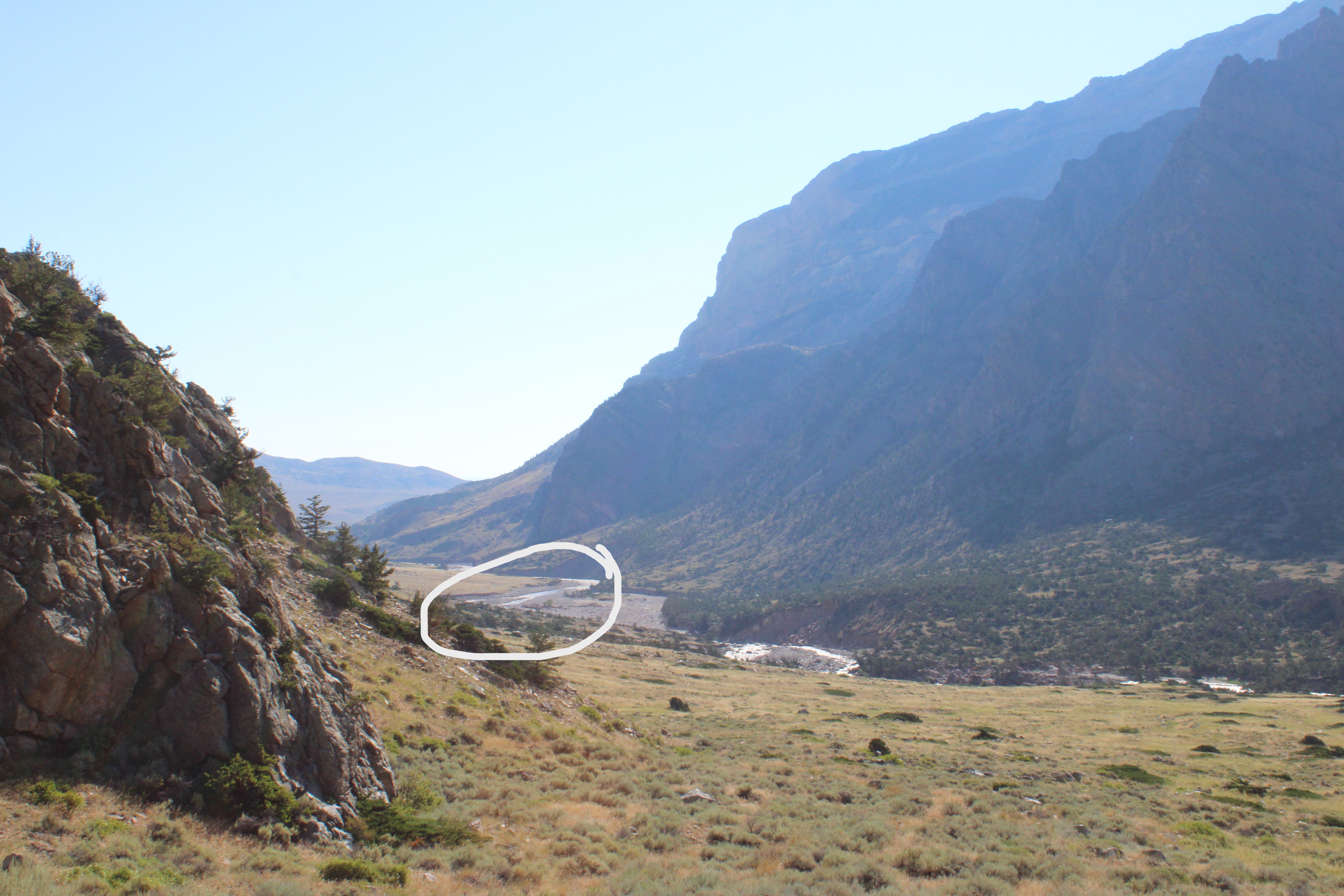
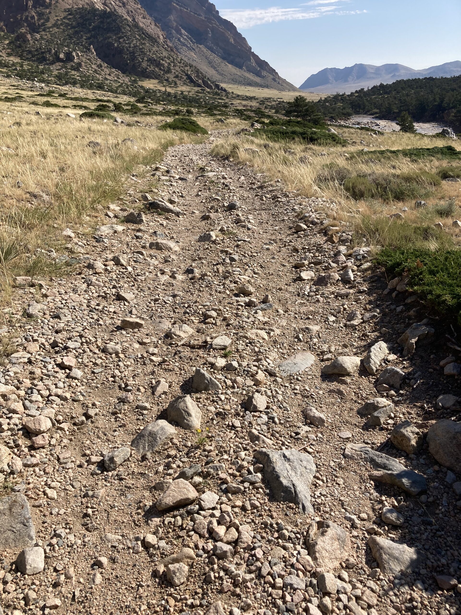
While on our way to the trail up to Bridal Veil Falls, we walked along the Morrison Jeep Trail. The trail was very clearly defined but not meant for hikers. I was worried about rolling an ankle because it was so rocky.

This rather rocky trail kept me watching my footing.

We followed the Jeep Trail for about an hour before we turned right to head up to the falls.

Being with Mark gave me interesting insight because he had been to Clark Fork’s Canyon and Bridal Veil Falls several times in the past before the flooding. There were sections where the trail suddenly stopped and dropped off down to the river bank that had not been like that before.

This really gave me an appreciation for the power of nature. You don’t really get to see it that much in Boston unless a hurricane rolls through.

There was no cover from the sun in the stretch leading up to The Falls’ trail but thankfully the weather on the day of our hike was perfect.
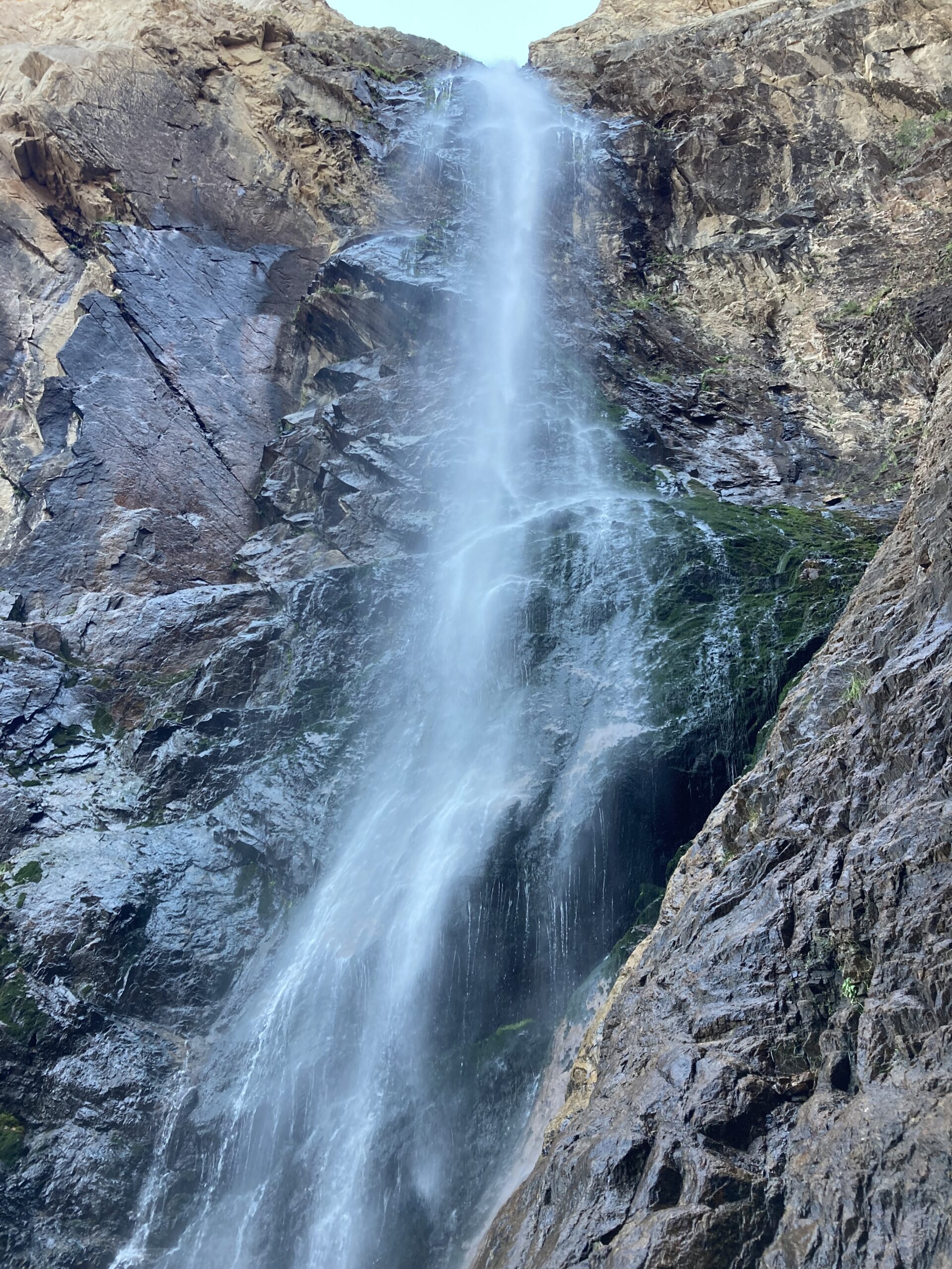
Bridal Veil Falls

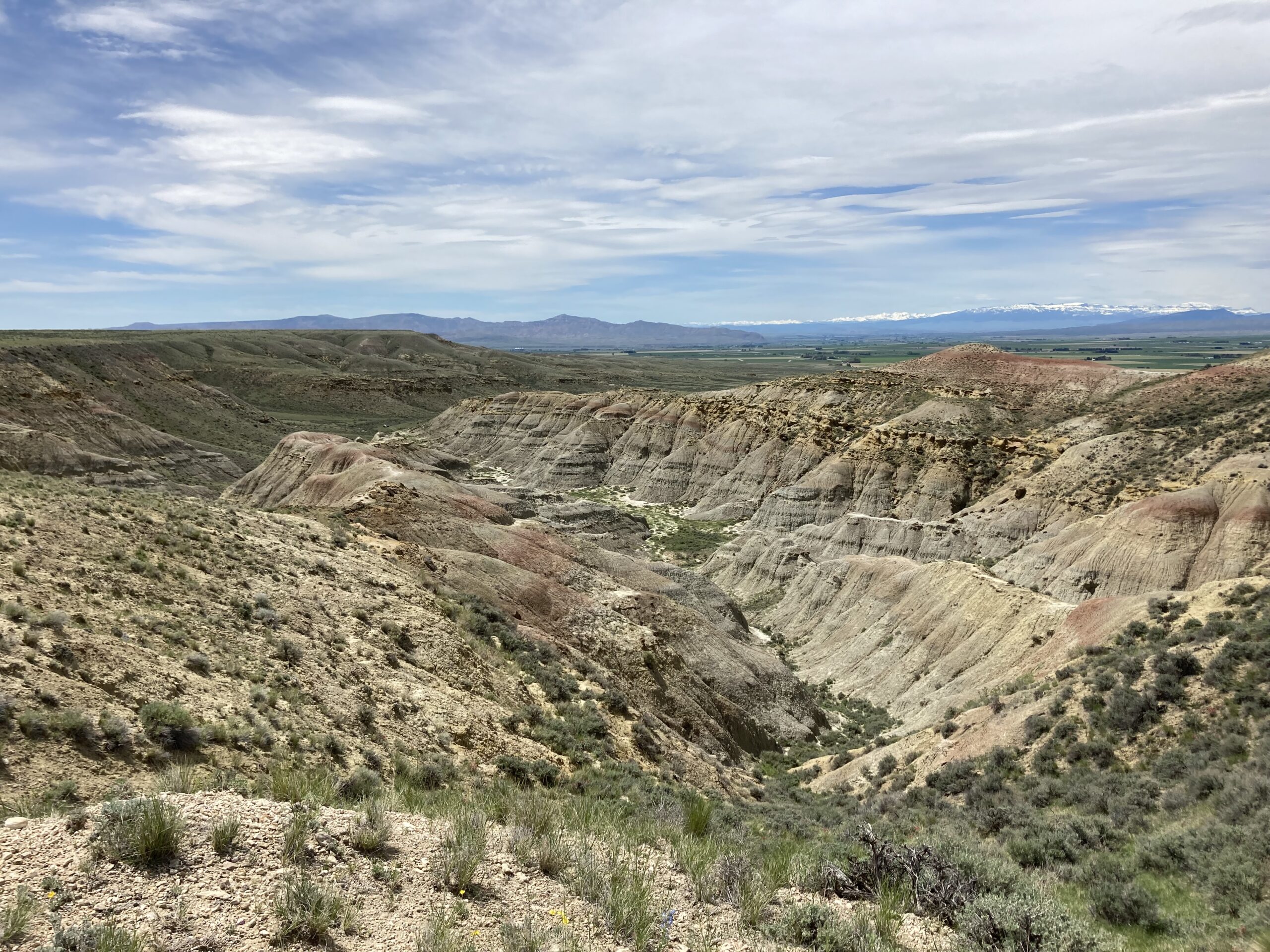
The trail leading up to the falls is very different from the canyon. This is due to it being tucked into the side of the canyon.

Just about all of the elevation gain takes place once you get out of the middle of the canyon (naturally). It is also far more shadowed and a bit cooler as a result.

Shadowed part of Clark Fork's Canyon, by Bridal Veil Falls.
It was nice and cool over here!

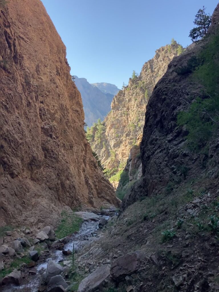
As you can see from the photo above here, there is a stream leading out from where the falls are. Something really cool about this was that there was some kind of mint growing close-by. I would’ve missed out on this little snack without Mark telling me!

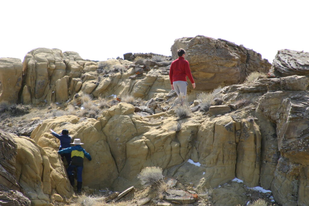
As we were getting up to the falls I got a bit nervous about slipping an falling. Many of the rocks were quite slick and I was wearing Teva sandals! We also did some scrambling and light climbing. Apparently, for the time of year we went the water level was a bit low. Hiking poles were extremely helpful for this hike. I honestly don’t know how I would’ve gotten up there without the added stability.

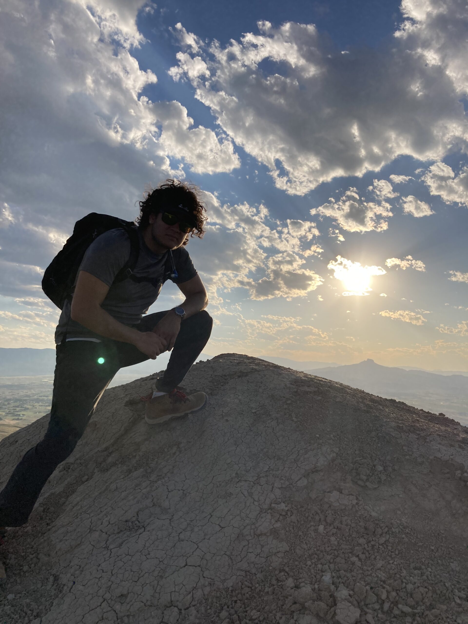
Once we completed this part of the hike, we were rewarded by an awesome closeup view of Bridal Veil Falls.

Just outside the splash-zone from here!

Rating: 3/5

I was really torn between giving this hike a 3 or a 4.

The scenery was incredible and I loved learning more about the area from Mark. But I cannot ignore the lack of infrastructure and how difficult it would be to find the Falls as a result.

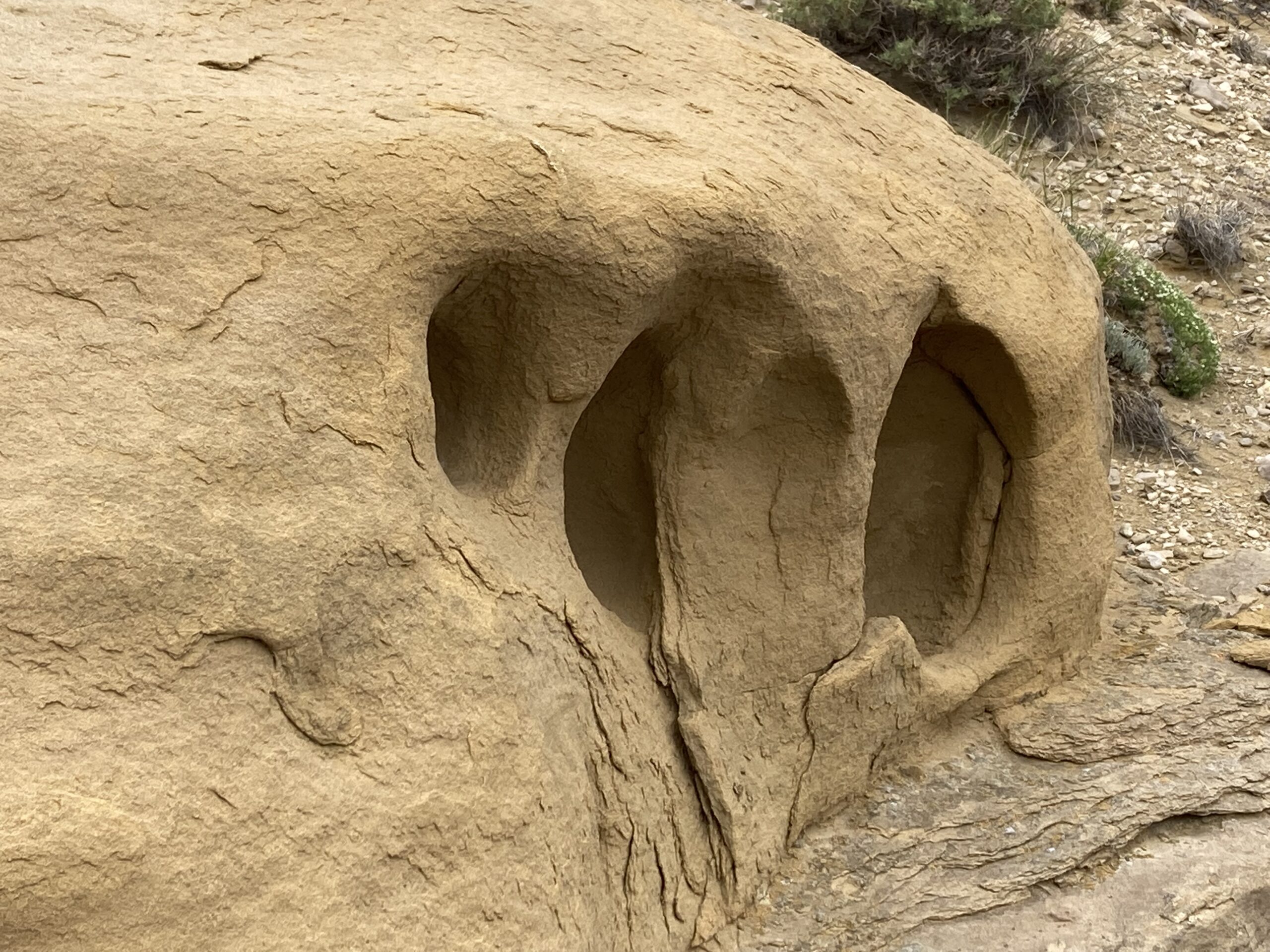
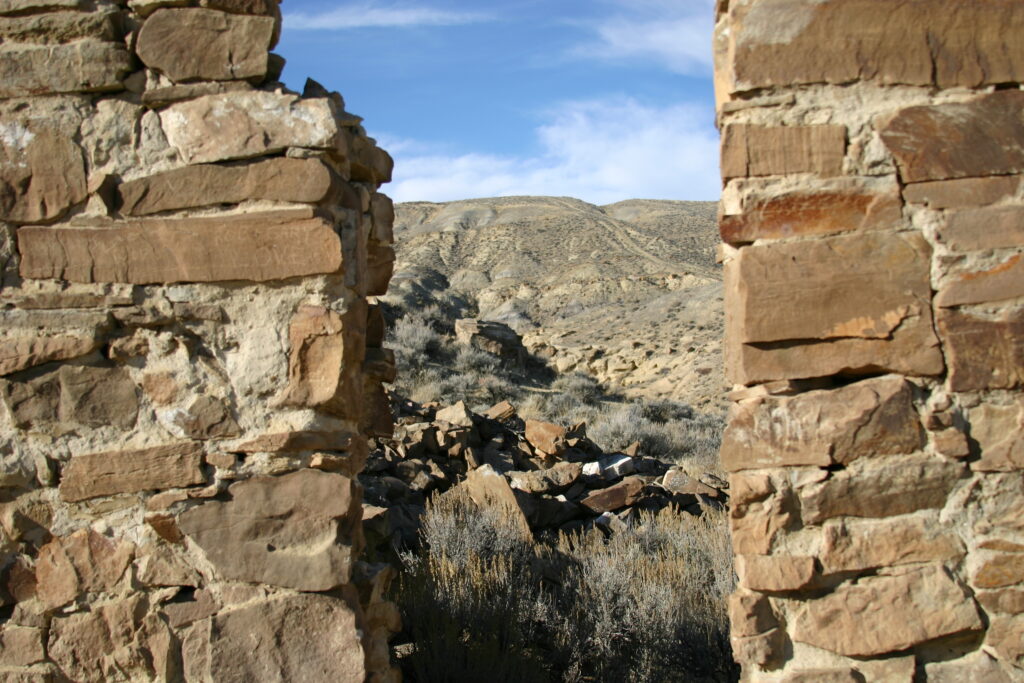
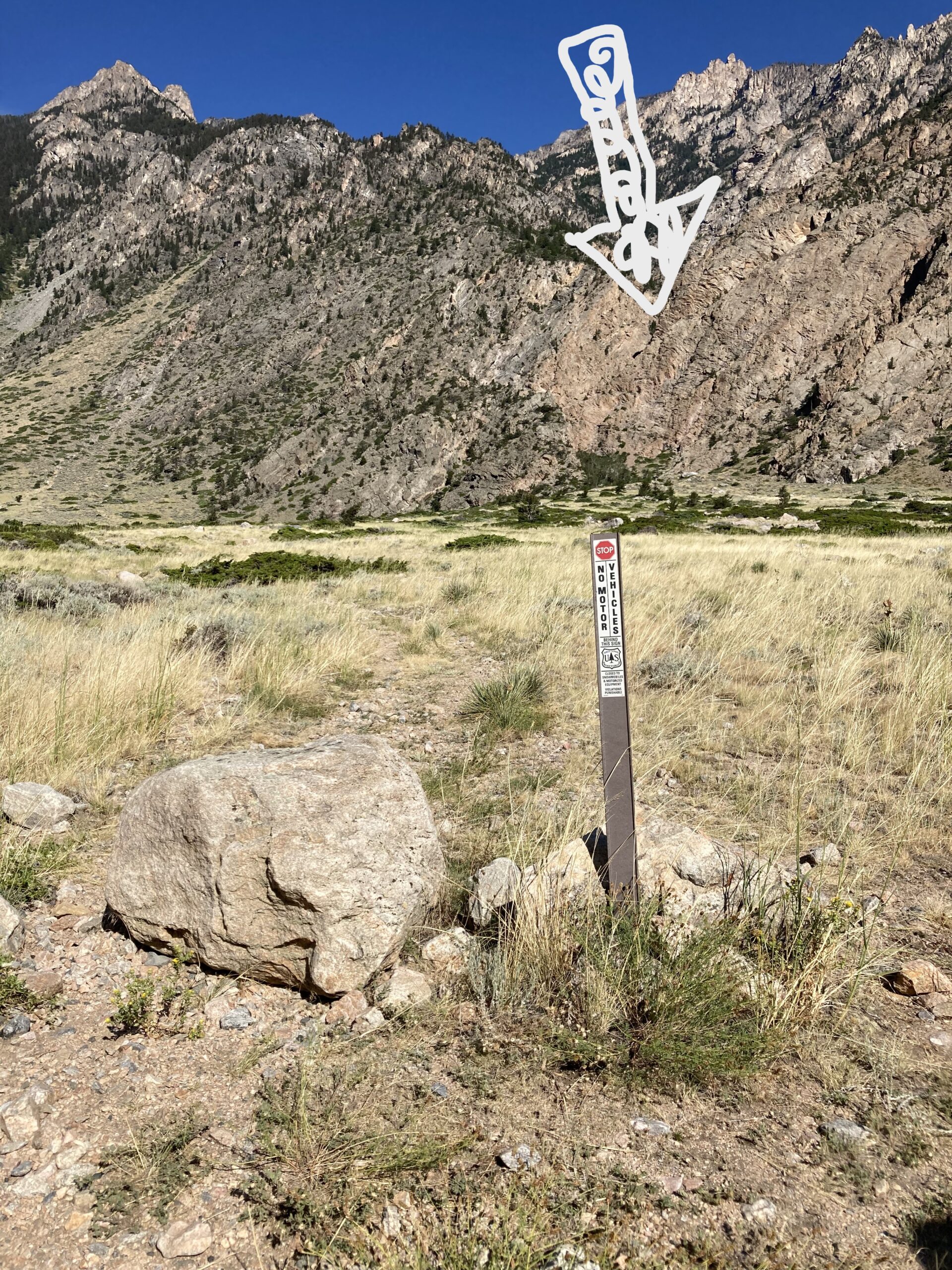
From the visitor perspective, I am struggling to see how someone who hasn’t been to Bridal Veil Falls before would be confident in finding where it is. In the photo above, you cannot even see the falls and the sign does not indicate that the falls are back there.

I also think that a family with younger kids would struggle with the stretch leading up to the falls due to the slippery rocks.

But overall, I had a great time!

What You Need to Know

  • Rattlesnakes have been seen in this area, practice rattlesnake safety
  • Slow down leading up to the parking area, if you don’t pay attention you could crash at speed
  • The path leading to the falls is marked by large rocks and a trail marker
  • I recommend hiking poles or some way to stabilize yourself

Get ready to hear about my time in the Beartooths!

Read more from me here!

Visitor Guide to Heart Mountain

Background on Heart Mountain

Heart Mountain is one of the most historically significant places I have been in my life. When talking about Park County, Wyomingites constantly recommend that I visit Heart Mountain. I always hear a different story about some piece of its history from people. Many local businesses and shops in Powell reference Heart Mountain in some way. It is a landmark that commands respect.

The Incarceration of The Japanese

When thinking about the background of Heart Mountain, the incarceration of the Japanese during World War 2 must to be mentioned first.

Shortly after the attack on Pearl Harbor, President Franklin D. Roosevelt signed Executive Order 9066. This Order put into motion the forced removal of Japanese and Japanese Americans from their homes to various incarceration camps.

People assembling at the Heart Mountain Incarceration Camp.
Photo courtesy of Yoshio Okumoto. People gathered at the Heart Mountain Incarceration Camp.

Over 120,000 people were forcibly removed from their communities, 2/3 were American citizens. Anyone with just 1/16th Japanese ancestry qualified. At the time, a vast majority of Americans agreed that this was the right thing to do.

One of the largest incarceration camps was at Heart Mountain.

The Heart Mountain Incarceration Camp held over 14,000 people for the three years it was in operation. At its peak, it contained over 10,000 people which made it the third largest “town” in Wyoming at the time.

The Heart Mountain Interpretive Center

Today, the Heart Mountain Interpretive Center stands at the site of the incarceration. Established in 2011, the museum serves as a stark reminder for this dark time in our nation’s history. It also celebrates the lives and resiliency of the Japanese and Japanese Americans who were wrongly held captive.

This museum captures what life was like for the people who were held at Heart Mountain during all phases of their captivity. From the hasty arrival, to the 3 long years, and the aftermath.

I took an afternoon to visit the Interpretive Center a couple of months ago. It was a powerful experience to not only learn about what happened but to read and listen to first hand accounts of what life was like for those who lived in the camp.

For the purposes of this blog I am limited to a brief summary. If you haven’t, I highly recommend taking the time to visit The Interpretive Center and learning more.

Special thank you to my friend Sybil who works at the Heart Mountain Interpretive Center! She took the time to read over this part of this article and offered advice for improving it.

Foretops Father

Heart Mountain is known to the Crow Nation as Foretops Father.

Legend has it that a Crow warrior named Foretop once traveled to Heart Mountain and fasted. While there, he had a vision of a man with a pompadour hairstyle. In the vision he was told that if he wore his hair in the same way he would live until the mountain collapsed. He was also told that whenever he fought against the Blackfeet, he would never lose.

A number of years later, part of Heart Mountain crumbled away and he was killed in battle.

The Crow people have passed this story down through many generations. Foretops Father remains incredibly important to the Crow. Unfortunately, when the Crow Nation was relegated to its reservation in Montana, Foretops Father was not included in this land.

Heart Mountain’s Geology

Heart Mountain is a mysterious wonder for modern geologists.

Known as the Heart Mountain Detachment, 49 million years ago this area was the site of the largest terrestrial landslide in the history of the planet.

An area of 450 square miles that was about 1 mile thick violently shifted over an unusually flat surface (just 2ยฐ downhill slope). It is thought that this massive chunk went so fast at the time of the shift that it approached the speed of sound. Imagine that!!

It is estimated that the Heart Mountain Detachment took anywhere from a few minutes to a couple of hours to travel about 30 miles where it eventually settled.

Volcanic activity is thought to be the culprit here. The mystery lies in how such a monumentally large expanse of land and rock moved over such flat ground.

To learn more about the Heart Mountain Detachment, check out this website!

Access

The Nature Conservancy manages the Heart Mountain trail.

Visiting Heart Mountain has been the smoothest experience I’ve had in Park County. Similarly to McCullough Peaks, a great positive for Heart Mountain is how close it is to Powell and Cody. I’d say Heart Mountain is right in the middle.

There are no negatives I can think of when thinking about access of Heart Mountain.

Apart from hiking, people are known to ride their horses up to the second trail head about halfway up the mountain. Past the trail head, only hikers are allowed.

Infrastructure at Heart Mountain

The signage leading up to Heart Mountain starts from Route 14 and is easy to follow all the way up to the visitor registration and trail head.

After turning off the highway the road switches to unpaved gravel after a few miles. But it is almost completely flat and there were no big rocks both times I’ve driven to Heart Mountain.

The ease of access and confidence I had in following the correct path did not end at the trailhead, but continued all the way to the summit.

Losing your way is next to impossible thanks to strategically placed trail markers. They are distinct and direct, leaving nothing up to interpretation.

Trail marker about halfway up Heart Mountain.

Apart from trail markers, there are also informational displays lining the trail which will will teach hikers about geology, plants/animals native to the area, natural history, and more! I counted over 50 of these displays. The past trips up the mountain that former incarcerees have made were my favorite topic!

An added bonus to the informational displays is that they help reassure you that you are going the right way. There were some clever examples of trail infrastructure that helped with this as well. It was comforting seeing anything man made as I traveled upwards to let me know I was staying on the trail. But its possible that the confusing experiences I’ve had left some mental scars though!

Logs arranged as stairs.

Its worth mentioning that the trail head has a parking area, restrooms, and a smaller interpretive center.

Lastly, there are 2 logbooks that live at the foot and summit of Heart Mountain. The visitor registration logbook is at the bottom. The one at the top is for triumphant hikers who can sign their name for bragging rights!

Directions

To reach the Heart Mountain Trail Head, it is easiest to turn off U.S. 14 Alternate (14A). If you are driving west from Powell you will turn right onto County Road 19 (Rd 19). If Driving east from Cody you will turn left onto Rd 19. There is a rectangular red sign to mark the turn that advertises the Heart Mountain Interpretive Center. You’ll also clearly see the museum and the old barracks right at the turn.

After taking the turn off 14A you will continue for about 5 miles on Rd 19. At this point you will be able to continue straight or take a left, keep going straight. You will get to the visitor registration kiosk in a minute or so.

From the kiosk it is just straight through to the trail head.

The Hike

This 7.8 mile out and back hike took me about 3 hours to complete. You can expect to climb well over 2000 ft. on this hike. This one is definitely a physical challenge. But I didn’t have to take any breaks to recover my energy.

Cows Everywhere

It was a rainy and overcast day when I first made my way to the top of Heart Mountain.

From the trail head, there is about 1ยฝ – 2 miles of rolling hills with at most short bushes. Normally people say this is the “worst” part of the hike. On hot sunny days it can be brutal to be exposed to the sun for so long. But for me this was not a problem as it was damp and cloudy.

The most notable part of these first couple miles for me was how many cows there were on and around the trail!

If looks could kill…

I also stopped to read all of the displays as I made my way through this section of the hike. One thing I learned that sticks with me is that from certain perspectives, Heart Mountain looks like the side profile of a person’s face as they are laying down. Ever since I saw that picture I can see the person every time!

This hike had an added element of fun because of these little pieces of information along the way. Especially for the first stretch when there is not much to look at other than cows and the mountain itself.

Past the Tree Line

Once I reached the tree line I was a little on edge. I had a friend tell me they’ve seen 3 bears at Heart Mountain in one day! Being from the east coast, I’ve never had to worry about anything more than a sunburn while outside. So being aware of a top predator was a little nerve wracking for me. There was definitely a distinct feeling I remember when thinking of the possibility of coming across a bear with nothing in between me or it.

Not long after reaching the tree line I came across the second trail head. From this point it was a consistent climb all the way to the top. This part of the hike looks like a coiled up snake on the map due to all the switchbacks.

Due to the weather I found myself walking through clouds as I got close to the summit which I haven’t ever done before so I thought that was awesome.

The views from the top of Heart Mountain are breath taking. Clouds completely covered the summit once I reached it. Once the clouds cleared the reveal was amazing. Below I’ll share a couple of the best pictures I got when I was up there.

A smaller peak I saw from the top of Heart Mountain, covered in clouds.

Rating: 4/5

Heart Mountain deserves a 5 from an infrastructure and access standpoint.

The ease in which I was able to complete this hike was a breath of fresh air in comparison to my other solo hikes. During the whole hike I was totally confident in finding my way. This allowed me to focus on enjoying the hike.

This set Heart Mountain apart from a visitor standpoint. I wouldn’t have a second thought about recommending someone brand new to Park County to try and hike up Heart Mountain.

As I was writing this post, I was unsure about whether or not I’d give Heart Mountain a 4 or a 5. Ultimately, I had to go with a 4 because of the first half of the hike. The couple of miles leading up to the tree line are underwhelming.

When I think of some of the other hikes I’ve done, Heart Mountain didn’t quite amaze me like some others have from start to finish.

What You Need to Know

  • Be bear aware! Here is some info about bear safety. I’ll add that bear spray is a MUST, if you come in to the PEP office you can check out some bear spray we have (I’m at the desk on Mondays!).
  • The trail is open seasonally, it closes during the winter.
  • Can’t bring dogs!
  • Due to the lack of cover for the first half, it is better to get an early start to avoid the sun.

Up next I’ll tell you guys about the time I hiked to Bridal Veil Falls up in Clark Fork’s Canyon!

As always, you can read more from me here.

McCullough Peaks Review

Background on McCullough Peaks

McCullough Peaks is a Wilderness Surveillance Area in between Cody and Powell, though it is closer to Cody. The Peaks are badlands. The word “badlands” has an interesting backstory! The name comes from the indigenous Lakota people who originally described the Badlands National Park in South Dakota as “mako sika“. This directly translates to “bad lands”. The reasoning is because the area is rocky, lacking water, and has extreme temperatures.

I think the Lakota people nailed it! (This picture was my LinkedIn profile background for a little bit!)

Today, there are a number of ways that people enjoy their time in McCullough Peaks. No matter what you like, something fun can be done at one of The Peaks’ many off-road trails and paths. People are known to ride off-road vehicles, go horseback riding, mountain bike, hunt on a limited basis, camp, and hike.

People also hunt for fossils here! McCullough Peaks is rich with fossils. Millions of years ago, The Peaks were warm and swampy. Fossils of old crocodiles, lemurs, and other mammals from that time have been known to be hiding around the area!

If you would like to learn more about the history of The Peaks, here is a great article from a PEP contributor that dives deeper!

Wild Horses in The Peaks

McCullough Peaks has large expanses of open plains-like land. One of the major draws to this area is the chance to see a herd of wild horses (which I unfortunately did not)! The wild horse herd management area protects this herd. Rumor has it that this particular herd are descended from the horses used in Buffalo Bill’s Wild West Show! There is a guide service in Cody that leads groups on wildlife spotting tours in The Peaks. That information can be found here.

The Cody based non-profit Friends of a Legacy (FOAL) is dedicated to keeping the horses of McCullough Peaks “wild” and “free”. Operating since 2006, this organization has been working hand in hand with the BLM. To support their efforts please consider donating so that this local attraction can continue to thrive.

The Hike

I had to phone a friend for the hike Iโ€™m about to describe! A buddy and I hiked/scrambled our way through the McCullough Peaks Divide Trail. He had been to the area a few times before and knew of some of the more popular trails. To be clear, this hike took place on a different visit to The Peaks.

This hike is an out and back trail that is about 6 miles round trip. It took my friend and I ~three hours to complete. If you are up for a physical challenge, this hike is for you! There is a fair amount of scrambling we did that was tough on my bad knee (yes, people in their 20’s can have a bad knee).

Sun hits small hill JUST RIGHT. Highlighting the amazing colors of this landscape.

Despite the physical pain I enjoyed clambering up and over the little rolling hills this hike took us on. It kept my mind engaged on what was right in front of me because I was so focused on not falling and listening for rattlesnakes. I like situations like this where you can just turn your brain off and be totally in the moment.

It was tremendously satisfying to get to the summit and be rewarded with great views and the right to sign our names in the logbook stashed up there. It was cool to read through all of the names on the list and see the little notes they left behind!

The state of the trail made this hike confusing. In multiple sections the trail would disappear or branch off in several ways. We would go one way and then see the trail off to the side of us. Following the trail was unclear for most of this hike.

Eventually we gave up on trying to stay on the path. We figured out where the summit was and headed straight for it.

Ain’t no mountain high enough. Heart Mtn can be seen in the background on the right.

New Territory for Me!

I had never seen anything in my life that looks like McCullough Peaks before I moved to the American West. The North East is covered in trees and littered with streams and little ponds/lakes. Then of course we have the Atlantic ocean right next door. The Peaks were so strange to me because I had never seen badlands before. The lack of trees was a shock!

Nothing does not mean boring or uninteresting, the views from McCullough Peaks are stunning. You have sightlines for what seem like 100s of miles. Nearby mountain ranges and prominent features of the landscape reveal themselves as you climb higher.

Overlooking Cody: Heart Mtn, Rattlesnake Mtn, and the Absaroka Mtn range can all be seen from The Peaks!

McCullough Peaks is the second hike I completed after arriving to Park County for my VISTA service. It was amazing being so high up because being from Boston we are obviously at sea level! It feels like no matter where you are in Park County you are at least 5,000 feet above that.

Something I’m a little embarrassed to share with you is that during my interview for this job I bragged about climbing a mountain that topped out at 5,000 feet! To those curious I’m talking about Mt. Lafayette in the White Mountains up in New Hampshire. Before I looked at maps of Park County I thought this was a massive mountain. I thought this would make me seem ready for anything I would have to tackle out here. Come to find out, the shortest mountain in Park County has that beat by 1000’s of feet!

An Interesting Conversation

As I was scaling the sides of McCullough Peaks in my Honda Accord I came across two tourists from the Greater Boston area! This is where I’m from in case you haven’t read my first blog post (check it out!). They were on the road to Yellowstone.

I’m devoting a small section here to what we talked about because I think it is relevant to the entire reason I am writing this blog.

The herd of wild horses drew them to the area. When I asked, they said they were not aware of any other place to see in Park County other than Yellowstone and The Peaks. So from a tourist standpoint, wild horses seems to be of significant interest.

The couple shared a lot of the confusion I had about signage at McCullough Peaks. They noticed the map at one of the access points but they were unsure of how long the road was or where any points of interest were. Park County is difficult to navigate for newcomers because they do not think to download any maps as they will not expect to lose cell service.

However, they shared similar concerns that locals may have about promoting the area. They were concerned about the area flooding with people. So any changes to infrastructure should be minimal to avoid overcrowding in their opinion.

Access

Positives

The Bureau of Land Management (BLM) almost entirely manages McCullough Peaks. There is also some private and state owned land. There are no fees at any of the entry points of The Peaks. If you like, you can camp at no cost for a maximum of 14 days. They can kick you out if they find you I guess!

One great positive about McCullough Peaks is that it is so close to Powell and Cody. I would say this is a place you can go to spend most of the day, an afternoon, or just a couple of hours given how close it is! The entry points are clear and distinct, all having a map of the area provided by the BLM and various notices posted on kiosks.

Closeup of the map at the entrance close to the Cody airport.

Negatives

While the map is helpful, it is too large and cannot show with detail all of the branching paths off of the main road. How about a “You are here”? I had never been to McCullough Peaks before and I was very new to the area at the time so I really wasn’t sure where I was on the map.

Picking a hiking trail was confusing. The lengths of the designated hiking trails are unmarked which was slightly intimidating. Like when I went to Polecat Bench, I simply googled “McCullough Peaks” on Maps and it did not show me any of the popular trails. This made it confusing because I was not sure which hike I should’ve done. I drove to the point google picked out but there were no trails at that spot. Eventually I made my way through the entire area without ever figuring out where the popular hikes are. This is why I had to come back with a friend.

It is worth mentioning that there are no restrooms, trash cans, or clear places to park at McCullough Peaks. While parking is not clear there is plenty of space to do so.

Lastly, access is far easier with a 4WD vehicle with a lot of clearance or an ORV. I was lucky because I went on a dry day, if it had rained the road would have been impossible for me.

Rating 3/5

The best part about McCullough Peaks is that if you were to camp there for the full 14 days, you’d have something new to do every day. There are a variety of ways to enjoy what McCullough Peaks has to offer. While driving on the main road I saw people riding dirt bikes/ORVs, hiking, looking for wildlife, and searching for fossils. Out of all the places I’ve been so far, I saw the most people here.

The views from The Peaks are incredible, even though the summit does not even come close to the height of Park County’s mountains. It almost feels as if you are walking on the surface of a different planet at times once you get a clear view of the immediate and surrounding landscape.

Based on what I just said you’re probably wondering why I’m giving McCullough Peaks a 3/5. The confusing aspects are really holding this one back from being a 4 or even a 5 on a good day.

The first time I came to The Peaks I didn’t even get out of my car to hike as I said earlier. I didn’t know how long the trails were or where the popular hiking spots were either. Signage and trail maintenance needs to improve here for this score to go up.

What You Need to Know

  • Here is a link to the most popular hikes at McCullough Peaks!
  • Its doable without, but I recommend a vehicle with high clearance and 4WD
  • Download your map!
  • Be wary of rattle snakes. Here is some information about rattlesnake safety.
  • Be aware that there are no restrooms at McCullough Peaks.

What’s Next?

I’m hoping to post every other Monday starting on October 17th.

Get ready to read about my first time hiking up Heart Mountain! You can read more from me and other contributors to PEP here.

Polecat Bench Review

Background of “The Bench”

First up in my series of reviewing outdoor recreation opportunities in Park County is Polecat Bench! The Bench is located just a few miles north/northwest of Powell. Making this spot one of the few quick drives from town (for me at least).

Polecat Bench is a raised terrace-like feature which does not quite tower over Powell but can be clearly seen from just about anywhere in town. The Bench stands out from a geologist perspective. I could not hope to understand as much as the experts to explain why, so here is some interesting information that can explain it much better than I can! My friend Mark Fisher, an expert in geology, created and maintains this website!

Getting There

I donโ€™t even know where to start.

Going into these hikes, I approached them as a visitor. To find a place to park and access polecat bench I just googled โ€œpolecat benchโ€ on maps. Which is how anyone not from here would try to find it.

This took me down 14A heading west from Powell. I turned right on 294 and drove for about 4 โ€“ 5 miles. Google wanted me to take a right but there was no road at all. There was just a barb wire fence. So, I doubled back and found a place to turn to access the bench. This took me down a dirt trail that eventually forked. My car was incapable of going left due to the conditions of the trail, so I went right. I followed this trail for about 2 miles and parked close to the slopes leading up to the bench.

There are no signs telling people where to go or a trailhead anywhere. This made getting where I wound up very confusing. The only reason I stopped was because there was nowhere else to go! My car was also not suited for driving on the trail that I went on. I was worried that when I stopped it would fall apart!

Overlooking my car from the top of Polecat Bench.

There are no entrance fees anywhere on polecat bench. In this way access was easy. However, various landowners have split the bench up into different sections. It is helpful to understand who owns the land you will be on but as I said you donโ€™t have to pay for access. You just need to be respectful of the owners where it is privately owned.

The Hike

Man was this quite the adventure.

Polecat Bench was the first place I went after I arrived in Park County. I knew next to nothing about it going in, just that locals would use this place to dump trash in years past.

Letโ€™s just say I can see why!

There was not much going on at The Bench. Once you get up on top of it there is just a sea of sage brush stretching as far as you can see in every direction. There are some tire tracks crisscrossing all over the top of it. I was also able to make out some interesting figures that were A LOT farther away than I thought when I first saw them. But Iโ€™ll get into that a little later.

The Bright Side

Thatโ€™s not to say my experience was negative! Iโ€™ve been hard on Polecat Bench so far, but I had a lot of fun poking around and exploring the sides and the top. On the slopes leading up to the bench, there are rocks that look very out of place in such a desolate area. This is because the Shoshone River used to run through The Bench thousands of years ago. I kept thinking that the next rock I turned over would have an amazing fossil!

There is a rich, natural history here that I could not help but feel connected to while looking at the features of this old riverbed. I imagined what used to be a river running right where I was standing. My car and I wouldโ€™ve been completely underwater! There were many rock formations I could not help but stare at as I was walking past. They took on so many shapes and sizes. I found myself wondering how they got to look as they do now!

How do you think these spaces in this rock were created? It looks so out of place here!

Saying that though once youโ€™ve seen it there is not much value in going back to look at rocks realistically. Unless that is something important to you of course. It only takes a few minutes to scamper up and down the sides of the bench, and there is almost no variation in the landscape on the top.

I found myself wandering aimlessly while I was there. Nothing really attracted me and made me want to go explore.

Now letโ€™s circle back to those figures in the distanceโ€ฆ

I Got Super Lost

Yeah, apparently things on the horizon of a completely flat surface are a lot farther away than they look.

After looking around and hiking for a few hours I saw some shapes in the distance across polecat bench. Being the diligent outdoor recreation planner that I am, I decided it was my duty to find out what they are.

From where I was standing on the top, they looked maybe 2 or 3 miles away from where I was. I had plenty of light left in the day. So, I figured Iโ€™d go see what they were, then walk back to where I parked and go home.

Big mistake.

I walked for a good hour and these shapes looked just as far away from where I first started. I came across some sort of structure that I rested at for a minute then decided to throw in the towel and turn around.

Now to get to these shapes I had turned off the trail way back when I first started walking over. This is where I really messed up. For some reason, I thought I would be able to walk in a completely straight line and somehow keep track of the angle that I was walking at in my head so that I could get back to my car (??).

As I was walking back it became very obvious that I was in a completely different area of polecat bench. I couldnโ€™t see where my car was because it was tucked into the slopes leading up to the bench. I ended up running around the top looking for anything recognizable. But when everything looks exactly the same that proved to be challenging.

It took me an extra 2 hours to finally find my car.

My car was tucked down in this area. From this different angle you can’t even tell it’s here!

What I Wish I Knew Going In

Obviously, I must start here with knowing the correct place to access polecat bench. There is a more common access point where people ride ORVs and mountain bikes, as well as hike. This point can be accessed from Powell by driving north on state highway 295. After about 7 miles turn right onto LP Oilfield Road. There is a place to park immediately after you turn off the highway right after the cattle guard.

Later I was told that rattlesnakes are known to settle around the bench. So, I definitely wish I hadnโ€™t been stomping around the top for several hours off the trail!

It wouldโ€™ve been great to know about the great mountain biking trail that is up there! I went back after this first experience and went mountain biking for the first time (Iโ€™ll talk about this in another post!).

Rating: 1/5

I hate to start off on a negative note here, but I owe my complete honesty to you. If I had to sum up my experience in one word it would be “confusing“.

While it was fun to explore, nothing at polecat bench really captured my interest or attention for very long. There are so many beautiful places in Park County that you can’t see anywhere else in the world, the bench is not one of those places.

Access was a total nightmare (if you don’t know where to go). As I was there I could not help but worry about anyone who might try to go the same way I did.

One positive the bench has going for it is how close it is to Powell. I mentioned this earlier, if you have a mountain bike or an ORV this is a great place to get a quick ride in. Polecat bench has potential in this aspect.

What’s Next?

For my next post, Iโ€™ll be talking about my experience at McCullough Peaks!

As always, you can find more from me here!

Meet Park County’s NEW Outdoor Recreation Planner!

Hello Park County!!

Allow me to introduce myself. My name is Kiran Darai. I am the new outdoor recreation planner working for Powell Economic Partnership (PEP) coming to you from the Greater Boston area!

A Little About Me…

  • I love the outdoors. I try to spend as much time as I can outside, particularly on my bicycle. I also enjoy hiking, swimming, camping, and any other way to soak up some sun!
  • An optimist to a fault, I like to think that I focus on the good in most situations.
  • Making people laugh brings me joy. I still remember the exact joke I told my doctor over 2 years ago that made him chuckle just a little bit!
  • Family is everything to me, and that includes my close friends!
  • I use exclamation points a lot!!
Your outdoor recreation planner in the wild at the New England Aquarium back home in Boston

VISTA on the Move

Now I should probably let you all know why Iโ€™ve moved all this way… Iโ€™m here in beautiful Park County because Iโ€™ve joined the AmeriCorps VISTA program. To make a long story short: AmeriCorps is a federal program. People join so that they can be placed in a community in the U.S. to volunteer. VISTA stands for Volunteers in Service to America.

All you need to remember is that as a VISTA, I am here to lend a helping hand to PEP to expand their capacity to better serve the Park County community. This position started this past June and will conclude next June in 2023.

I joined because Iโ€™m passionate about community health. There is nothing more powerful than a community coming together to solve the problems that face that community. Itโ€™s about lifting the quality of life for the collective through solutions that come from within. After all, who is better to ask than those who live with the problems?

Iโ€™ll bet youโ€™re wondering, โ€œwho is this guy, why should I care, and why did he come here?โ€.

Hopefully after I tell you about what Iโ€™m doing specifically you will see the value in my job and why you should read this blog!

Why do you Value Outdoor Recreation in Park County?

Goals for my Service Year

As the โ€œOutdoor Recreation Plannerโ€ I have a few goals that I need to accomplish during the time I will be in Park County. The first of those (and most interesting) being that I must understand what the people of Park County value in outdoor recreation. I need to know what you all love about recreating, what would get you outside more, and what may be stopping you from being outdoors as much as you would like. Iโ€™m excited to learn the answers to these questions because I will be using your responses to create a recommendation for improving the outdoor recreation experience in the county.

I think itโ€™s important for me to say that I will not be forcing any changes on you that are from me or the organizations I may be working with. Any recommendations I make will be completely informed by what YOU want. I am simply here to collect your opinions and organize them so that the people whose jobs it is to make any changes to outdoor recreation clearly know what you desire, if anything at all.

I need to understand the plans of agencies that own public land in Park County and how those plans affect what you all want when it comes to outdoor recreation. Iโ€™ll be collaborating with Bureau of Land Management, United States Dept. of Agriculture, Bureau of Reclamation, and other land owners!

Finally, I must โ€œdocument the user experienceโ€ of outdoor recreation in Park County. Itโ€™s exactly what it sounds like! Theyโ€™re making me hike, bike, kayak, camp, and spend time outside. Doesnโ€™t that sound horrible??

But! That doesnโ€™t quite explain why Iโ€™m writing this blogโ€ฆ

Inside Look on Outdoor Recreation from a New Resident

This blog will mainly contain my thoughts about all the adventures I will be going on in Park County. I will tell all of you where I went for the day, what I did, what I thought about it, what I wish I knew going in, and where I will be going next! Iโ€™m hoping you will get something out of reading about my travels and remember what it was like seeing the sights here for the first time again.

So! If you see me out and about (probably looking lost/confused) donโ€™t be a stranger! Odds are I probably need some help anyways. Feel free to stop me and tell me what youโ€™re thinking, Iโ€™d love to know!

""
What I usually look like while outdoors

You can find more from me here.

-Kiran

McCullough Peaks Historic Place to Explore

Sprawling Labyrinth of Colorful Badland Peaks

A few miles south of Powell sit a sprawling labyrinth of colorful badland peaks and dry-wash valleys. They are arid, highly eroded, and sometimes treacherous, but they also offer scenic views and fantastic opportunities for appreciating the Wyoming landscape.

Named after scotch immigrant and early cowboy Peter McCulloch, the area has a long history of livestock grazing, as well as harboring herds of wild horses.  

Peter McCulloch at his home in Worden, Montana after retiring from the range cattle business. Park County Archives photo.

Peter McCulloch came to northwest Wyoming in 1879 as the foreman of a cattle drive from Fort Bridger. His boss, Judge William A. Carter, had been invited by Chief Washakie of the Shoshone Tribe to move his sizable cattle herd from the drought-ridden southwestern section of the Territory to the Big Horn Basin, where the grass was still good for grazing.

The cow outfit made their headquarters along a small creek draining the northern slope of a craggy and elongated mass of high rock. McCulloch named both the creek and the mountain after his far-off boss.  

Peter McCulloch apparently detested the bleak badland formations south of what was then referred to as the Stinking Water River. Well aware of McCullochโ€™s feelings, his cowboy friends mockingly christened them โ€œMcCullochโ€™s Peaksโ€ during an 1881 range roundup where local inhabitants had begun assigning names to geographic landmarks. The current โ€œMcCulloughโ€ spelling was a later error printed on U.S. Geological Survey maps. 

Carter delegated much of his livestock and business responsibilities to McCulloch, who pastured all the ranch horses on the southern slopes of his eponymous peaks.

The Stone Barn of McCullough Peaks. Park County Archives photo.

Stone Barn

Sometime in those early years McCulloch and his fellow cowboys located a minor spring on the grassy northern slopes of the peaks. They excavated a small dugout into the hillside and regularly brought their herds to water. In 1904 a large stone barn was built at this location by early homesteader Frank Gilmore who used the facilities to raise purebred horses. The barn and adjacent corrals were later purchased by P.E. Markham for use as a lambing and shearing shed for his sheep operation, and then again by the Hoodoo Ranch as a remote cow camp. This stone barn still exists, although its roof has recently collapsed.

Later the McCullough Peaks became a popular area for sheep grazing and overwintering livestock. The southern facing slopes offered good winter forage to herds that often summered high up on their mountain pastures.

Large rock piles are plentiful around the peaks, most being sheepherder monuments or cairns erected to serve as landmarks and informal grazing boundary markers.

The McCullough Peaks are a sprawling landscape of badlands south of Powell, WY. Photo by Emily Swett.

The rugged character of the McCullough Peaks deterred most early settlers from permanently occupying the region as they preferred the lush and more easily irrigable lowlands along creeks and rivers. These circumstances have allowed the peaks to preserve a great deal of their wild and pristine landscape.

Today the McCullough Peaks consist of over 23,000 acres of public BLM land with some additional state-owned tracts. They harbor a plethora of outdoor recreation opportunities, from hiking and ATV travel, to horseback riding, trail running, mountain biking, hunting, birdwatching, photography, and wildflower identification.

How to Get There

Access to the McCullough Peaks from Powell, Wyoming on Lane 14 south of town. Additionally, McCullough Peaks can be found via the McCullough Peaks Road #1212 off the Greybull Highway west of Cody, or the Whistle Creek Road #1213 which travels north from the Greybull Highway (US 14/20/16) to Wyoming Highway 32. These are maintained BLM roads with some gravel or dirt surfaces. There are also numerous two-track trails that lead into and around the peaks from every direction. These are fun to travel and discover new routes, although they should be avoided when the ground surface is wet.

No discussion of the region would be appropriate without remarking upon the work of local author and historian Phyllis Preator, who has written two books about the McCullough Peaks and their inhabitants. Her first, entitled โ€œThe McCulloch Peaks: Early History & Storiesโ€ provides an account of adjacent homesteaders, herders, and ranchers who have historically frequented the area. Preaterโ€™s most recent book, โ€œFacts and Legends behind the McCulloch Peaks Mustangsโ€, highlights the wild horses in the area and the natural history of American mustangs in general.

Enjoy the Region with Geotourism in Powell, Wyoming

Whether youโ€™re a longtime Powell local or visiting the area from abroad, Powell is a fantastic basecamp for family-friendly outdoor recreation and exploration.ย  From mountain biking to skiing to fishing, there are endless opportunities to explore designated recreation areas.ย  However, if youโ€™re looking for new ways to enjoy the region, consider geotourism in Powell, Wyoming.

What is Geotourism?

Geotourism turns the landscape and geological sites into the destination rather than just the scenery you drive past on the journey to somewhere else. The phrase was coined in England in the early 1990s, and it has grown in popularity due to the explosion of ecologically conscious tourism known a ecotourism.

Whatโ€™s the Difference Between Ecotourism and Geotourism?

Geotourism is for geologically curious travelers.ย  Whereas ecotourism celebrates flora and fauna, geotourism focuses on geomorphology–the physical characteristics of the Earthโ€™s surface. ย ย Though you may be headed to Yellowstone to see bison, elk, and grizzly, you can couple your ecotourism with geotourism by visiting the alluvial fan formation in the dramatic Clarks Fork Canyon or take a detour to visit the 300-million-year-old Heart Mountain, which came into formation when this high desert was a tropical sea.ย 

Who Are Geotourists?

Walk, hike, climb, or sit in your car, geotourism in Powell, Wyoming is for the young and old, able-bodied and disabled.ย ย  One wonderful aspect of geotourism is that it only requires as much effort as you want to put into it.ย  The sheer grandeur of Wyomingโ€™s geological features can be appreciated from your vehicle, but if youโ€™re adventure seeking, geosites often have nearby hiking trails for seasonal recreationists.ย 

However you decide to view the spectacular geological formations, be sure to visit GeoWyo.com

Before you head out, donโ€™t forget to pack Fritz and Thomasโ€™s Roadside Geology of Yellowstone Country for enlightening commentary on the region.

3 Geosites within 45 minutes of Powell Wyoming

Polecat Bench (aka โ€œThe Benchโ€)

Polecat Bench is 10 minutes from downtown Powell. The closest destination on the list. The Bench is the unsung hero of geotourism in Powell, Wyoming.ย  Many locals donโ€™t even know the name of the looming bench-like formation that serves as the backdrop to Powell.ย  However, Ivy League universities have been setting up camp on Polecat for decades to study its unique paleontology.ย  Significant fossils have been found here. ย 

While youโ€™re here, see if you can locate the remnants of the old stage stop. 

Hint: If you come across a section of slick rock that would make for great mountain biking, youโ€™re close!  Wear boots and pack your snake bite kit.

Clarks Fork Canyon

As you drive through the vast moraine fields on Canyon Road, the mouth of the Clarks Fork Canyon reveals its breathtaking scale.  42 minutes from Powell, the free-flowing Clarks Fork River tumbles down from Colter Pass.  Though the energy of the Clarks Fork River is something to behold, itโ€™s really the anticline that serves as the centerpiece of this miraculous vista.

On the south side of the river, the Bald Mountain anticline shoots up from the valley in a stunningly naked display of motion over time.  It is a radical and breathtaking sight that any viewer can appreciate.  To the north side of the river, sharp and angular Chugwater formations rise from the red dirt like rock fins.  To get a different perspective, hike the Bridal Falls trail and behold the same formations from the interior of the canyon. 

The kicker: subsurface mapping suggest that the Clarkโ€™s Fork region is still developing!

Man has made his mark own mark in this canyon with rocks too.  As you walk along the river, keep an eye out for the remnants of Native American tepee rings.

Heart Mountain

Lovingly named, Heart Mountainโ€™s geological biography suggests that the worldโ€™s largest landslide transported the rock from its original birthplace dozens of miles away in the Beartooth Range.  Now, Heart Mountain rises from the Big Horn Basin like a lone and bold sentinel.  How did it get so far from home, you wonder?  Well, research suggests that the release of carbon dioxide gas below the surface created an air cushion similar to the of a hovercraft.  This served to reduce friction as it was deliver to its current resting place.

On your way to visit the mountain, take in a lesson from more recent history at the Heart Mountain Interpretive Center.ย  The Interpretive Center was formally a Japanese internment camp during World War II, and its current mission is to tell the story of Japanese internment camps to future generations.

There is endless opportunity for exploration in the Powell area. So if you like this article, keep an eye for more ways to enjoy the region near Powell on your way to Yellowstone National Park. Did you know Yellowstone National Park is the size of Rhode Island and Delaware combined? Here are some hacks to maximize your Yellowstone trip.

Yellowstone National Park Travel Hacks

This is an amazing place but can quickly become more of an adventure then you bargained for. These Yellowstone National Park travel hacks will ensure you have the best experience.

National Parks are on your travel list and youโ€™ve narrowed your trip down to Yellowstone National Park. Get excited, here are the major highlights. Yellowstone Lake is the largest high-elevation lake in North America. Plan to spend some time on the water. There are sixty-seven mammal species, from massive bison to cute river otters. Get off the roads and walk on the trails, youโ€™ll see more wildlife. Seek out native cultures. Before Yellowstone was designated as a national park twenty-six tribes used its resources.

#1 Yellowstone is the size of a small state.

It is larger than Rhode Island and Delaware combined. So, unless you are on a bus tour or have scheduled a shuttle you will need your own transportation.

#2 Pick a gate. Hint, The East Gate is the Best Gate.

Yellowstone spans three states (Wyoming, Montana and Idaho). The majority of Yellowstone is in Wyoming. Thatโ€™s right, Wyoming = Yellowstone. Actually 53% of Yellowstone is in Park County, Wyoming. Powell is in Park Country, Wyoming (arenโ€™t we lucky). The gates (entrances) into the Park very in size, landscape and animal activity. BONUS: When you travel to the Park from the East, you get to experience the United States’ first National Forest, Shoshone National Forest. If you are looking often you will see moose, bears, and buffalo before you enter Yellowstone.

#3 Pick a gate community.

Each gate has a town close to it. The South Gate is Jackson, the West Gate is West Yellowstone, the North Gate is Gardiner, the Northeast Gate is Cook City, and the East Gate is Cody. Powell, Wyoming is just 20 miles northeast of Cody and we have two gates that are easily accessible by vehicle, the East Gate and the Northeast Gate. Each of the gate communities are distinct.

#4 Cell service is spotty.

Isnโ€™t this kind of the point of our National Parks? Unplug, unwind, go ahead and take those selfies and send them a little later. Keep a map of the park with you so you donโ€™t get lost. The best places to get cell service are Lake Village, Grant Village, Canyon Village, Old Faithful, West Yellowstone, Mammoth Hot Springs and Gardiner, MT.

#5 Again, Yellowstone is the size of a small USA state.

While there are gas stations in the park they arenโ€™t around every geiser. Fill up your tank before you enter the park. Keep it full.

#6 You are at elevation, in the Park and in the surrounding communities.

Drink water, stay hydrated. You have spent time planning your trip and paying for it. Do you really want to get sick due to dehydration, nah.

#7 The animals are wild.

Not like theme park, well fed, will not approach your jeep wild. The kind of wild that is live or die wild. So, donโ€™t approach the Buffalo…use the zoom instead. The friendly Park Rangers give a pamphlet of what types of animals are in the park and how far away you need to view them. Read it.

#8 Get off the roads. Get into the park.

Hike some trails. Bike some trails. You traveled all the away from your busy city to be in nature. Get in nature. Yellowstone National Park fills your soul in a kind of way that little other places do. Our great President Teddy Roosevelt knew what he was doing when he declared this land to belong to the people.

#9 Bring bear spray. The animals are wild in Yellowstone.

Grizzly bears live in the park. They are meat eaters. Black bears live in the park. They eat lots of plants but also eat meat. If you surprise either kind of bear they may attack you. That is when you pull out your bear spray which is in the holster on your body, per the manufacturer instructions, not in your backpack were you canโ€™t reach it.

#10 Bison do ram cars.

Bison are herd grazing animals. Often they will be to the side of the road or on the road. Mostly they will just keep walking; but, Buffalo are wild animals and you never know!

Not sure about what to bring, where to stay, and what to do in Yellowstone National Park? Ask a local. The Powell Visitor Center is here to help. We love talking about our National Treasure and surrounding region.

#11 Gates open and close for the season. Plan your visit. 

Yellowstone is a wild place located in the states of Wyoming, Montana and Idaho. It is a mountainous region with high elevations. Roads close during the winter months. And, winter comes early in Yellowstone. When planning this trip of a lifetime first consult the Yellowstone Live Roads Map. This page also outlines gate opening and closing, current road status, and road maintenance projects.

#12 Look good and layer up. 

Packing your suitcase for all types of weather is always a good Yellowstone travel hack. Especially, if you are visiting in spring (May) or fall (September and October). Include a windproof/ water resistant winter coat, hat, and gloves. It will allow you to stay outside longer to enjoy the beautiful views. It is function over fashion here. Bring hiking boots or good walking shoes. Yellowstone is more fun if you get on the designated trails and off the boardwalks.

Looking for more Yellowstone National Park travel hacks? Ask a local the Powell Visitor Center is here to help give us a call or send us an email. We are happy to give you all the inside info.